Port Orange in Volusia County, Florida — The American South (South Atlantic)
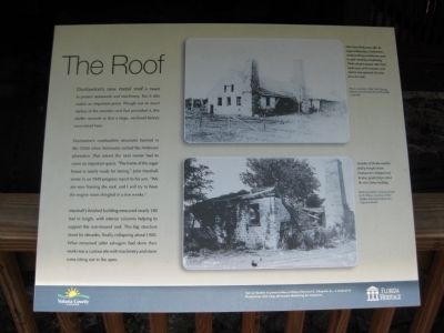
The Roof
Dunlawton's combustible structures burned in the 1830's when Seminoles sacked the Anderson plantation. That meant the next owner had to cover and important space. "The frame of the sugar house is nearly ready for raising," John Marshall wrote in an 1849 progress report to his son. "We are now framing the roof, and I will try to have the engine room shingled in a few weeks."
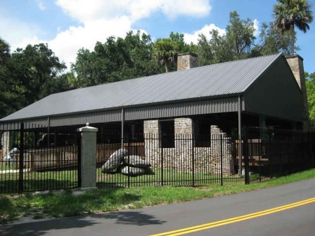
Marshall's finished building measured nearly 180 feet in length, with interior columns helping to support the non-trussed roof. This big structure stood for decades, finally collapsing about 1900. What remained (after salvagers had done their work) was a curious site with machinery and stone ruins sitting out in the open.
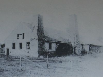
[ Photo ]
More than thirty years after its sugar-making days, Dunlawton's sturdy building probably was used in cattle ranching and farming. While old photographs often show north views of the structure, park visitors now approach the ruins from the south.
Photo courtesy of the Port Orange Historical Trust/Harold and Priscilla Cardwell.
[ Photo ]
Decades of Florida weather finally brought down Dunlawton's shingled roof. In time, people forgot about the site's frame building.
Early twentieth-century photo by S. Shear, courtesy of the Halifax Historical Museum, Daytona Beach.
Special thanks to preservation architect Herschel E. Shepard, Jr. - a student of Dunlawton who long advocated sheltering its resources.
Erected by Volusia County and the State of Florida, Department of State, Division of Historical Resources, assisted by the Florida Historical Commission.
Topics. This historical marker is listed in these topic lists: Architecture • Industry & Commerce • Wars, US Indian. A significant historical year for this entry is 1849.
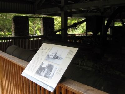
Location. 29° 8.474′ N, 81° 0.336′ W. Marker is in Port Orange, Florida, in Volusia County. Marker can be reached from Old Sugar Mill Road east of Herbert Street, on the left when traveling east. The marker is on the grounds of the Dunlawton Sugar Mill Botanical Gardens, mounted along the boardwalk at the sugar mill ruins. Touch for map. Marker is at or near this postal address: 950 Old Sugar Mill Road, Port Orange FL 32129, United States of America. Touch for directions.
Other nearby markers. At least 8 other markers are within walking distance of this marker. Working (here, next to this marker); From the Boardwalk (a few steps from this marker); The Most Dangerous Chieftain (a few steps from this marker); Telling Dunlawton's Stories (a few steps from this marker); Sugar Making (a few steps from this marker); Living on the Edge (within shouting distance of this marker); The Dunlawton Sugar Factory (within shouting distance of this marker); Dunlawton's Building Blocks (within shouting distance of this marker). Touch for a list and map of all markers in Port Orange.
More about this marker. The marker features the logos of Volusia County and the Florida Heritage program.
Regarding The Roof. The site was listed with the National Register of Historic Places in 1973 under the name Dunlawton Plantation--Sugar Mill Ruins (# 73000606).
Related markers. Click here for a list of markers that are related to this marker. To better understand the story of the Dunlawton Plantation and Sugar Mill Ruins, study each marker in the order shown.
Credits. This page was last revised on August 19, 2020. It was originally submitted on August 26, 2011, by Glenn Sheffield of Tampa, Florida. This page has been viewed 637 times since then and 20 times this year. Photos: 1. submitted on August 26, 2011, by Glenn Sheffield of Tampa, Florida. 2, 3, 4. submitted on August 27, 2011, by Glenn Sheffield of Tampa, Florida. • Bill Pfingsten was the editor who published this page.


