Merriam in Johnson County, Kansas — The American Midwest (Upper Plains)
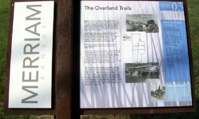
The Overland Trails
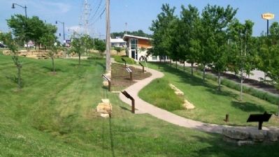
Merriam Historic Plaza Walking Path
Historic Frontier Trails cut through the territory now known as Merriam. Hundreds of thousands of people emigrated [sic – immigrated] to the western frontiers along the Oregon and California Trails. The Santa Fe, Oregon and California Trails all shared a route in the Kansas City metropolitan area, the only place in the United States where this occurred.
In the Kansas City area, the Santa Fe Trail had two routes coming off the Missouri River – one from Westport and one from Independence. The Westport route of the Santa Fe Trail rain [sic] southwest through modern northeast Johnson County, one branch coursing south near Merriam’s eastern border.
Two historic trails ran directly through Merriam, the California Road and the Fort Leavenworth Military Road.
The California Road was originally a trail that headed west through the lands of the Shawnee. This trail came into prominent use in the 1850’s when the dangers of the “Border War” drove emigrant traffic destined for Oregon and California onto this road. The California Road joined the Oregon-California Trail near Lawrence. The California Road ran west through Merriam, south of modern day Johnson Drive.
The Fort Leavenworth Military Road was created in 1837 as part of a route the federal government had designated as the boundary line of the permanent Indian frontier. Running from Fort Snelling in Minnesota to Fort Towson in Oklahoma, the road was used to move troops between Leavenworth and Fort Scott. The Fort Leavenworth Military Road crossed southeast through present day Merriam, where travelers stopped along Turkey Creek. The road continued to the eastern edge of Indian Territory and then south to Fort Scott.
About the Images
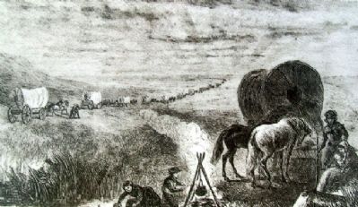
Covered Wagons, 1869 -
This lithograph portrays wagon trains following the Oregon-California Trail.
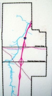
Frontier Trails Map -
Thousands of emigrants and merchants traveled over these roads in loaded wagons that cut into the earth as they rode west. Today, the faded signatures of those passages can still be found across the Kansas City area.
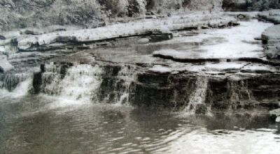
Turkey Creek -
“We were soon free of the woods and bushes, and fairly upon the broad prairie…At noon we stopped to rest not far from a little creek, replete with frogs and young turtles”.
This excerpt from The Oregon Trail published by Francis Parkman in 1846 describes Parkmans’ [sic] stop along Turkey Creek in Merriam while traveling west on the California Road.
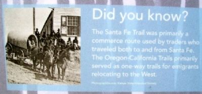
Did you know?
The Santa Fe Trail was primarily a commerce route used by traders who traveled both to and from Santa Fe. The Oregon-California Trails primarily served
as one-way trails for emigrants relocating to the West.
Erected 2006 by City of Merriam. (Marker Number 03.)
Topics and series. This historical marker is listed in these topic lists: Communications • Forts and Castles • Roads & Vehicles • Settlements & Settlers. In addition, it is included in the Overland Trail series list. A significant historical year for this entry is 1837.
Location. 39° 0.873′ N, 94° 41.446′ W. Marker is in Merriam, Kansas, in Johnson County. Marker is at the Merriam Visitors Bureau, near Exit #228B of Interstate 35, and immediately southwest of the intersection of Shawnee Mission Parkway (US 56) and Eby Avenue. Touch for map. Marker is at or near this postal address: 6304 East Frontage Road, Mission KS 66202, United States of America. Touch for directions.
Other nearby markers. At least 8 other markers are within walking distance of this marker. The Founding of Campbellton (here, next to this marker); Shawnee Friends Mission (here, next to this marker); The People of the South Wind & the Coming of the Shawnee (a few steps from this marker); Merriam Park & George Kessler (a few steps from this marker); The Trolley Line & Hocker Grove Amusement Park (a few steps from this marker); The Bear Pit (within shouting distance of this marker); Education in Merriam
(within shouting distance of this marker); The South Park Community (within shouting distance of this marker). Touch for a list and map of all markers in Merriam.
Also see . . .
1. Santa Fe National Historic Trail. (Submitted on September 4, 2011, by William Fischer, Jr. of Scranton, Pennsylvania.)
2. Oregon National Historic Trail. (Submitted on September 4, 2011, by William Fischer, Jr. of Scranton, Pennsylvania.)
3. California National Historic Trail. (Submitted on September 4, 2011, by William Fischer, Jr. of Scranton, Pennsylvania.)
4. Explore Merriam, Kansas. (Submitted on September 4, 2011, by William Fischer, Jr. of Scranton, Pennsylvania.)
Credits. This page was last revised on January 6, 2022. It was originally submitted on September 4, 2011, by William Fischer, Jr. of Scranton, Pennsylvania. This page has been viewed 892 times since then and 32 times this year. Photos: 1, 2, 3, 4, 5, 6. submitted on September 4, 2011, by William Fischer, Jr. of Scranton, Pennsylvania. 7. submitted on September 6, 2011, by William Fischer, Jr. of Scranton, Pennsylvania.
