Leitersburg in Washington County, Maryland — The American Northeast (Mid-Atlantic)
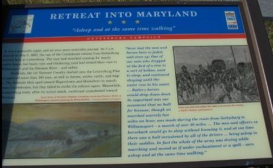
Retreat into Maryland
"Asleep and at the same time walking"
It was a miserable night, and an even more miserable journey. As 3 a.m. neared on July 5, 1863, the van of the Confederate retreat from Gettysburg arrived here at Leitersburg. The men had marched nonstop for nearly twelve hours, but heavy rain and thickening mud had slowed their race to Williamsport and the Potomac River - and safety.
Suddenly, the 1st Vermont Cavalry dashed onto the Leitersburg Pike and captured more than 100 men, as well as horses, mules, cattle, and wagons. The Federals then sped toward Hagerstown and Boonsboro in search of more Confederates, but they failed to strike the column again. Meanwhile the Leitersburg train, after its initial shock, continued unmolested toward the Potomac.
"Never had the men and horses been so jaded, and stove up. One of our men who dropped at the foot of a tree in a sort of hollow, went to sleep, and continued sleeping until the waster rose to his waist. ...Battery horses would drop down dead. So important was our movement that no halt for bivouac, though we marched scarcely two miles an hour, was made during the route from Gettysburg to Williamsport - a march of over 40 miles. ...The men and officers on horseback would go to sleep without knowing it, and at one time there was a halt occasioned by all the drivers ... being asleep in their saddles. In fact the whole of the army was dozing while marching and moved as if under enchantment or a spell - were asleep and at the same time walking."
Erected by Maryland Civil War Trails.
Topics and series. This historical marker is listed in this topic list: War, US Civil. In addition, it is included in the Maryland Civil War Trails series list. A significant historical month for this entry is July 1925.
Location. 39° 41.788′ N, 77° 36.845′ W. Marker is in Leitersburg, Maryland, in Washington County. Marker is at the intersection of Ringold Street and Ringold Pike (County Route 418), on the right when traveling south on Ringold Street. Located at a pull of inside the triangle of the intersection. Touch for map. Marker is in this post office area: Hagerstown MD 21742, United States of America. Touch for directions.
Other nearby markers. At least 8 other markers are within 4 miles of this marker, measured as the crow flies. Gettysburg Campaign (here, next to this marker); Erected in Honor of the Boys of Leitersburg District (approx. half a mile away); Leitersburg Bridge No. 2 (approx. 0.6 miles away); Good-Hartle Farm (approx. 1.2 miles away); Old Forge Farm (approx. 2.8 miles away); Old Forge Bridge (approx. 2.9 miles away); a different marker also named Gettysburg Campaign (approx. 3.3 miles away); Memorial to World War II Korea and Vietnam Veterans of Smithsburg and Community (approx. 3.6 miles away). Touch for a list and map of all markers in Leitersburg.
More about this marker. On the lower left is a painting of "Lee's Army of Northern Virginia retreating across the Potomac River at Williamsport, postwar painting by Edwin Forbes." On the right is a drawing showing "Rain and mud intensified the misery of retreat after losing a battle (Battles and Leaders)."
Photographed By Craig Swain, November 3, 2007
3. Passes Used by Confederates
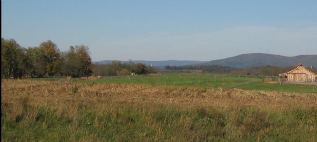
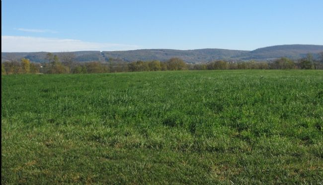
Seen from the marker's location, the passes in the distance on the Maryland - Pennsylvania state line through South Mountain were used by the Confederate infantry retreating from Gettysburg. Passing through Monterey Pass on the east side, the columns exited the mountain and marched southwest toward Hagerstown.
Photographed By Craig Swain, November 3, 2007
4. Cavalry Used the Passes to the South
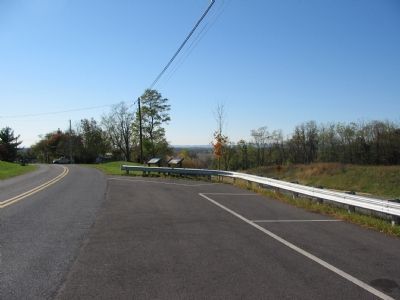
To the east of the Leitersburg marker are some of the passes in Maryland used by Confederate cavalry. On the far left of the photo left of where the power lines cut through the trees, is Raven Rock Hollow used by Stuart's Confederates making their way from Thurmont on the east side of South Mountain. To the right is a wider pass leading to Pleasant Valley. Kilpatrick's Federal cavalry guarded both approaches while positioned at Smithburg.
Credits. This page was last revised on June 16, 2016. It was originally submitted on January 14, 2008, by Craig Swain of Leesburg, Virginia. This page has been viewed 1,591 times since then and 12 times this year. Photos: 1, 2, 3, 4. submitted on January 14, 2008, by Craig Swain of Leesburg, Virginia. 5. submitted on July 31, 2011.
