New London in New London County, Connecticut — The American Northeast (New England)
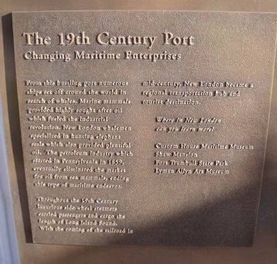
The 19th Century Port
Changing Maritime Enterprises
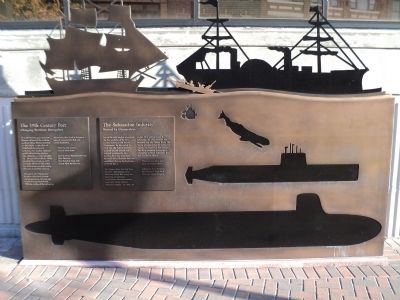
From this bustling port numerous ships set off around the world in search of whales. Marine mammals provided highly sought after oil which fueled the industrial revolution. New London whalemen specialized in hunting elephant seals which also provided plentiful oil. The petroleum industry which started in Pennsylvania in 1859, eventually eliminated the market for oil from sea mammals, ending this type of maritime endeavor.
Throughout the 19th Century luxurious side-wheel steamers carried passengers and cargo the length of Long Island Sound. With the coming of the railroad in mid-century, New London became a regional transportation hub and tourist destination.
Topics. This historical marker is listed in these topic lists: Industry & Commerce • Waterways & Vessels. A significant historical year for this entry is 1859.
Location. 41° 21.26′ N, 72° 5.657′ W. Marker is in New London, Connecticut, in New London County. Marker is at the intersection of State Street and Bank Street, on the right when traveling west on State Street. Touch for map. Marker is in this post office area: New London CT 06320, United States of America. Touch for directions.
Other nearby markers. At least 8 other markers are within walking distance of this marker. The Submarine Industry (here, next to this marker); The Atlantic Trade (here, next to this marker); The Amistad Incident (here, next to this marker); The Roots of the US Coast Guard (here, next to this marker); Native Americans (a few steps from this marker); 54 State Street (a few steps from this marker); 80 State Street (within shouting distance of this marker); Revolutionary New London (within shouting distance of this marker). Touch for a list and map of all markers in New London.
Credits. This page was last revised on May 6, 2023. It was originally submitted on October 14, 2011, by Bill Coughlin of Woodland Park, New Jersey. This page has been viewed 388 times since then and 8 times this year. Photos: 1, 2, 3, 4. submitted on October 14, 2011, by Bill Coughlin of Woodland Park, New Jersey.


