Greenbrier West in Chesapeake, Virginia — The American South (Mid-Atlantic)
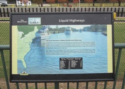
Liquid Highways
The Waterways
Competition from the railways and the re-structured Dismal Swamp Canal Company signaled the downfall of the Albemarle and Chesapeake Canal Company in 1910. By 1913, Congress, recognizing the economic value of an inland waterway along the East Coast, bought the canal, authorized the Atlantic lntracoastal Waterway and placed it under the control of the United States Army Corps of Engineers.
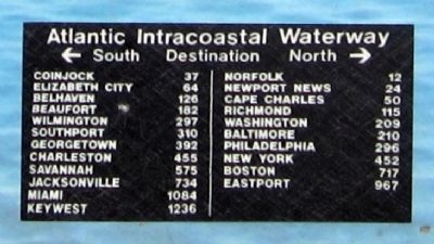
The Albemarle and Chesapeake Canal was made part of the Intracoastal Waterway in 1919. The Atlantic Intracoastal Waterway allows vessels to go from Florida to Maine without the danger of ocean currents and weather. Today, a variety of vessels travel this liquid highway, from commercial barges to pleasure craft.
Erected by Chesapeake Bay Gateways Network.
Topics. This historical marker is listed in this topic list: Waterways & Vessels. A significant historical year for this entry is 1910.
Location. 36° 43.419′ N, 76° 14.814′ W. Marker is in Chesapeake, Virginia. It is in Greenbrier West. Marker can be reached from Locks Road, 0.6 miles west of North Battlefield Boulevard (Virginia Route 168), on the left when traveling west. Located in Great Bridge Lock Park. Touch for map. Marker is in this post office area: Chesapeake VA 23320, United States of America. Touch for directions.
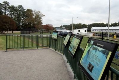
Other nearby markers. At least 8 other markers are within walking distance of this marker. The Iron Titans Tame the Marsh (here, next to this marker); Why Build a Canal Here? (here, next to this marker); What is a Lock? (here, next to this marker); Bridging the Past with the Present (within shouting distance of this marker); The Battle of Great Bridge (within shouting distance of this marker); Welcome (within shouting distance of this marker); Village of Great Bridge (about 500 feet away, measured in a direct line); Marine Veterans Memorial (approx. 0.4 miles away). Touch for a list and map of all markers in Chesapeake.
Also see . . . Great Bridge Lock Park - Chesapeake, VA. Chesapeake Bay Gateways and Watertrails Network (Submitted on October 30, 2011, by Bernard Fisher of Richmond, Virginia.)
Credits. This page was last revised on February 1, 2023. It was originally submitted on October 30, 2011, by Bernard Fisher of Richmond, Virginia. This page has been viewed 766 times since then and 19 times this year. Photos: 1, 2, 3, 4. submitted on October 30, 2011, by Bernard Fisher of Richmond, Virginia.


