Near McLean in Fairfax County, Virginia — The American South (Mid-Atlantic)
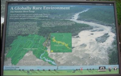
A Globally Rare Environment
The Potomac River Gorge
"In more than twenty-five years of field work, I have not seen another site with a comparable diversity of land forms, plants, and natural communities."
-Gary Fleming, Ecologist, Virginia DCR
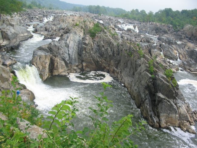
Look around you. Have you noticed the unusual landscape here? Because of this landscape's wild river and rocky terrain, this is one of the country's most biologically diverse areas. Bedrock terraces high above the river, precarious ledges and floodplains have become a fragile home to over 30 distinct plant communities, three of which are not found anywhere else in the world. What has and continues to cause this diverse, rare life to exist? The river before you is the answer.
As you explore this 2.5-mile long trail you will encounter 14 trailside exhibits illustrating the unique features of the Potomac River Gorge and the important role it fills within the watershed.
Erected by George Washington Memorial Parkway, National Park Service, U.S. Department of the Interior.
Topics. This historical marker is listed in these topic lists: Environment • Natural Resources.
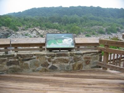
Location. 38° 59.753′ N, 77° 15.2′ W. Marker is near McLean, Virginia, in Fairfax County. Marker can be reached from the intersection of Old Dominion Drive and Georgetown Pike (Virginia Route 193). Located along the Great Falls National Park main trail, at an overlook of the falls. Touch for map. Marker is in this post office area: Great Falls VA 22066, United States of America. Touch for directions.
Other nearby markers. At least 8 other markers are within walking distance of this marker. People and the Potomac (here, next to this marker); River of Change (here, next to this marker); Patowmack Canal (about 300 feet away, measured in a direct line); a different marker also named The Patowmack Canal (about 400 feet away); Floods at Great Falls (about 400 feet away); Olmsted Island (about 500 feet away in Maryland); a different marker also named The Patowmack Canal (about 700 feet away); Matildaville (approx. ¼ mile away). Touch for a list and map of all markers in McLean.
More about this marker. The backdrop of the marker is an overhead photograph of the Falls and the gorge. A map illustrates the Potomac River Watershed, with a pull out map of the gorge. "What is a Watershed? It's an area of land from which rainwater and snowmelt drain into a larger body of water. Everybody lives in a watershed."
Also see . . . Great Falls Park. National Park Service site detailing the falls and the park. (Submitted on January 26, 2008, by Craig Swain of Leesburg, Virginia.)
Credits. This page was last revised on September 19, 2021. It was originally submitted on January 26, 2008, by Craig Swain of Leesburg, Virginia. This page has been viewed 1,367 times since then and 18 times this year. Photos: 1, 2, 3. submitted on January 26, 2008, by Craig Swain of Leesburg, Virginia.


