Near Lee Vining in Mono County, California — The American West (Pacific Coastal)
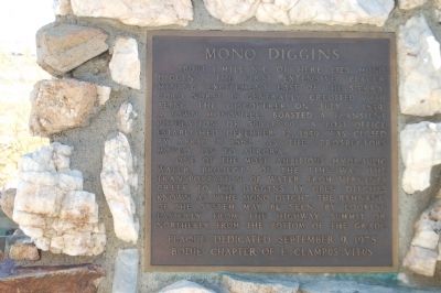
Mono Diggins
One of the most ambitious hydraulic water projects of the time was the transportation of water from Virginia Creek to the Diggins by open ditches known as “the Mono Ditch”. The remnants of the system may be seen by looking easterly from the highway summit or northerly from the bottom of the grade.
Erected 1978 by E Clampus Vitus, Bodie Chapter No. 64.
Topics and series. This historical marker is listed in this topic list: Settlements & Settlers. In addition, it is included in the E Clampus Vitus series list. A significant historical month for this entry is April 1881.
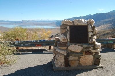
Location. 38° 4.44′ N, 119° 10.613′ W. Marker is near Lee Vining, California, in Mono County. Marker is on State Highway 395. The marker is located at the Mono Lake Vista Point below the south side of Conway Summit, 8 miles north of Lee Vining. Touch for map. Marker is in this post office area: Lee Vining CA 93541, United States of America. Touch for directions.
Other nearby markers. At least 8 other markers are within 6 miles of this marker, measured as the crow flies. Avalanche of 1911 (approx. 1.8 miles away); Grave of Adeline Carson Stilts (approx. 4.7 miles away); Lundy (approx. 4.7 miles away); The De Chamber Family (approx. 4.8 miles away); From Scrubland to Ranchland (approx. 4.8 miles away); De Chambeau Ranch (approx. 4.8 miles away); Little Bodie (approx. 5.3 miles away); Dynamo Plant and Pond (approx. 5.6 miles away). Touch for a list and map of all markers in Lee Vining.
Also see . . . Monoville, California - First Official Township on the Eastward Rush. (Submitted on November 28, 2011, by Barry Swackhamer of Brentwood, California.)
Credits. This page was last revised on June 16, 2016. It was originally submitted on November 28, 2011, by Barry Swackhamer of Brentwood, California. This page has been viewed 1,238 times since then and 35 times this year. Photos: 1, 2, 3, 4. submitted on November 28, 2011, by Barry Swackhamer of Brentwood, California. • Syd Whittle was the editor who published this page.


