Rome in Oneida County, New York — The American Northeast (Mid-Atlantic)
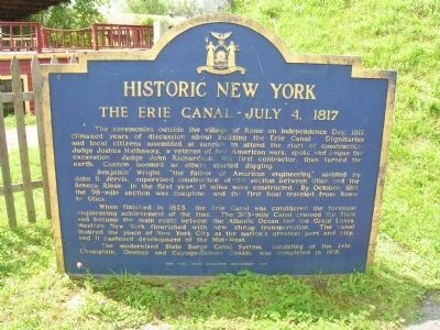
The Erie Canal - July 4, 1817
Historic New York
Benjamin Wright, "the father of American engineering," assisted by John B. Jervis, supervised construction of the section between Utica and the Seneca River. In the first year, 15 miles were constructed. By October, 1819, the 98-mile section was completed, and the first boat traveled from Rome to Utica.
When finished in 1825, the Erie Canal was considered the foremost engineering achievement of the time. The 363-mile canal crossed the State and became the main route between the Atlantic Ocean and the Great Lakes. Western New York flourished with new, cheap transportation. The canal insured the place of New York City as the Nation's greatest port and city, and it hastened development of the Midwest.
The modernized State Barge Canal System, consisting of the Erie, Champlain, Oswego and Cayuga-Seneca Canals, was completed in 1918.
Erected 1967 by New York State Education Department.
Topics and series. This historical marker is listed in this topic list: Waterways & Vessels. In addition, it is included in the Erie Canal, and the Historic New York State series lists. A significant historical month for this entry is October 1819.
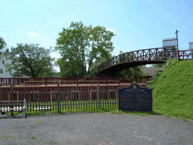
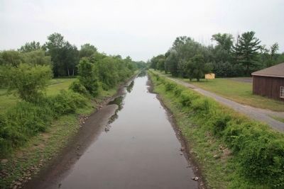
Location. Marker has been reported missing. It was located near 43° 13.552′ N, 75° 30.151′ W. Marker was in Rome, New York, in Oneida County. Marker could be reached from Fort Bull Road. The Marker was within the Erie Canal Village at the base of the embankment of the Fort Bull Road foot bridge over the canal. Touch for map. Marker was in this post office area: Rome NY 13440, United States of America. Touch for directions.
Other nearby markers. At least 8 other markers are within 3 miles of this location, measured as the crow flies. Erie Canal Enlargement (within shouting distance of this marker); Fort Bull (within shouting distance of this marker); Clinton's Ditch (about 500 feet away, measured in a direct line); a different marker also named Fort Bull (approx. 0.2 miles away); Erie Canal (approx. ¼ mile away); U.S. Arsenal (approx. 1.9 miles away); The Oneida Carrying Place (approx. 2.2 miles away); The Central N.Y. School for the Deaf (approx. 2.4 miles away). Touch for a list and map of all markers in Rome.
Also see . . . Erie Canal Village website.
(Submitted on December 12, 2011, by Bill Pfingsten of Bel Air, Maryland.)
Additional keywords. Clinton's Ditch
Credits. This page was last revised on October 1, 2019. It was originally submitted on December 10, 2011, by Howard C. Ohlhous of Duanesburg, New York. This page has been viewed 1,457 times since then and 68 times this year. Photos: 1, 2, 3. submitted on December 10, 2011, by Howard C. Ohlhous of Duanesburg, New York. 4, 5. submitted on April 9, 2012, by Dale K. Benington of Toledo, Ohio. • Bill Pfingsten was the editor who published this page.
