Upper Tract in Pendleton County, West Virginia — The American South (Appalachia)
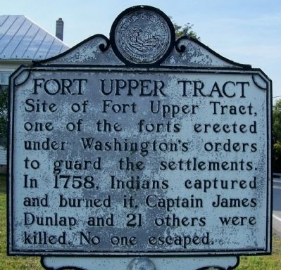
Fort Upper Tract
Topics and series. This historical marker is listed in these topic lists: Forts and Castles • War, French and Indian. In addition, it is included in the West Virginia Archives and History series list. A significant historical year for this entry is 1758.
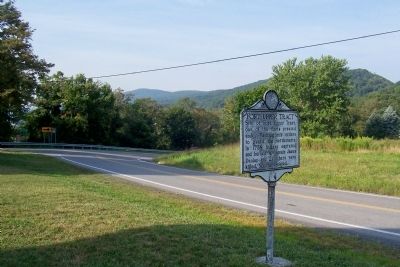
Location. 38° 47.257′ N, 79° 16.925′ W. Marker is in Upper Tract, West Virginia, in Pendleton County. Marker is on U.S. 220 just north of Schmucker Road, on the left when traveling south. Touch for map. Marker is in this post office area: Upper Tract WV 26866, United States of America. Touch for directions.
Other nearby markers. At least 8 other markers are within 6 miles of this marker, measured as the crow flies. Smoke Hole (approx. 1.3 miles away); a different marker also named Smoke Hole (approx. 2.2 miles away); Eagle Rocks (approx. 2.6 miles away); St. George’s Church (approx. 4.9 miles away); Organized Pendleton County (approx. 5.4 miles away); 10th Mountain Division (approx. 5.9 miles away); More Than One Way Up (approx. 5.9 miles away); Sites Homestead (approx. 5.9 miles away). Touch for a list and map of all markers in Upper Tract.
Credits. This page was last revised on June 16, 2016. It was originally submitted on December 11, 2011, by Forest McDermott of Masontown, Pennsylvania. This page has been viewed 869 times since then and 28 times this year. Photos: 1, 2. submitted on December 11, 2011, by Forest McDermott of Masontown, Pennsylvania. • Bill Pfingsten was the editor who published this page.

