Near Monaca in Beaver County, Pennsylvania — The American Northeast (Mid-Atlantic)
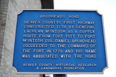
Brodheads Road
Erected by Beaver County Historical Research and Landmarks Foundation.
Topics and series. This historical marker is listed in this topic list: Roads & Vehicles. In addition, it is included in the Pennsylvania - Beaver County Historical Research and Landmarks Foundation series list. A significant historical year for this entry is 1778.
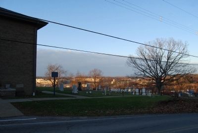
Location. 40° 40.1′ N, 80° 18.693′ W. Marker is near Monaca, Pennsylvania, in Beaver County. Marker can be reached from North Branch Road, 0.3 miles north of North Broadhead Road when traveling south. Located at North Branch Presbyterian Church. Touch for map. Marker is at or near this postal address: 139 North Branch Road, Monaca, PA 15061, Monaca PA 15061, United States of America. Touch for directions.
Other nearby markers. At least 8 other markers are within 2 miles of this marker, measured as the crow flies. Fort McIntosh Site (approx. 1.6 miles away); Fort McIntosh (approx. 1.6 miles away); a different marker also named Fort McIntosh (approx. 1.6 miles away); Fort McIntosh 1778 The Campaign (approx. 1.6 miles away); Fort McIntosh 1978 The Site Restoration (approx. 1.6 miles away); Commanding Officers (approx. 1.6 miles away); a different marker also named Fort McIntosh (approx. 1.6 miles away); a different marker also named Fort McIntosh (approx. 1.6 miles away).
Also see . . . Beaver County Historical Research and Landmarks Foundation. Website homepage (Submitted on December 25, 2011, by Mike Wintermantel of Pittsburgh, Pennsylvania.)
Credits. This page was last revised on August 10, 2022. It was originally submitted on December 25, 2011, by Mike Wintermantel of Pittsburgh, Pennsylvania. This page has been viewed 681 times since then and 36 times this year. Photos: 1, 2. submitted on December 25, 2011, by Mike Wintermantel of Pittsburgh, Pennsylvania.

