Near Sharpsburg in Washington County, Maryland — The American Northeast (Mid-Atlantic)
Jackson's Command
Hays' Brigade, Ewell's Division
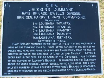
Jackson's Command.
Hays' Brigade, Ewell's Division.
Brig. Gen. Harry T. Hays, Commanding.
Organization.
5th Louisiana Infantry,
6th Louisiana Infantry,
7th Louisiana Infantry,
8th Louisiana Infantry,
14th Louisiana Infantry.
September 16-17, 1862.
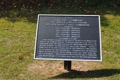
Hays' Brigade encamped on the night of the 16th in the woods northwest of the Dunkard Church. Soon after daylight of the 17th, it advanced and, near this point, crossed the Hagerstown Road to fill an interval between the brigades of Lawton and Trimble. After a short halt in the open fields south of the Cornfield, it was ordered to the support of Lawton's Brigade. It advanced into the Cornfield about 150 yards beyond Lawton, where, having lost more than one-half its numbers, it was relieved by Wofford's Brigade of Hood's Division and withdrawn to the fields south-west of the Dunkard Church.
Erected by Antietam Battlefield Board. (Marker Number 342.)
Topics and series. This historical marker is listed in this topic list: War, US Civil. In addition, it is included in the Antietam Campaign War Department Markers series list. A significant historical date for this entry is September 17, 1862.
Location. 39° 28.596′ N, 77° 44.82′ W. Marker is near Sharpsburg , Maryland, in Washington County. Marker is on Dunker Church Road / Old Hagerstown Pike, on the right when traveling south. Touch for map. Marker is in this post office area: Sharpsburg MD 21782, United States of America. Touch for directions.
Other nearby markers. At least 10 other markers are within walking distance of this marker. Longstreet's Command (within shouting distance of this marker); 59th New York Infantry (within shouting distance of this marker); a different marker also named Jackson's Command (about 300 feet away, measured in a direct line); Maryland State Monument (about 300 feet away); a different marker also named Jackson's Command (about 400 feet away); "Destroy the Rebel Army" (about 400 feet away); a different marker also named Destroy the Rebel Army (about 400 feet away); Beacon of Peace (about 400 feet away); Dunker Church - "Symbol of Peace and Brotherhood" (about 400 feet away); Dunkard Church (about 500 feet away). Touch for a list and map of all markers in Sharpsburg.
Related markers. Click here for a list of markers that are related to this marker. Follow Hays' Brigade by Tablets.
Also see . . .
1. Antietam Battlefield. National Park Service site. (Submitted on March 16, 2008, by Craig Swain of Leesburg, Virginia.)
2. Hays' Brigade. One of the more colorful Civil War organizations, Hays' Louisiana Brigade. In addition to the listed infantry regiments, the brigade had a three gun battery attached. The Louisiana Guard Artillery remained on Hauser Ridge to the west of the West Woods during the day, helping to repel the repeated Federal advances into that sector. (Submitted on March 16, 2008, by Craig Swain of Leesburg, Virginia.)
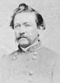
3. Harry T. Hays. Harry Thompson Hays (April 14, 1820 – August 21, 1876) was an American Army officer serving in the Mexican-American War and a general who served in the Confederate Army during the American Civil War. (Submitted on October 16, 2015, by Brian Scott of Anderson, South Carolina.)
Photographed By Craig Swain, February 9, 2008
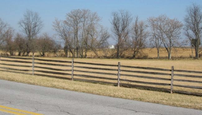
5. Hays' Brigade Moves into Position
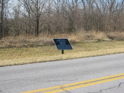
In the early morning hours of the battle, Hays' Brigade crossed the pike in this vicinity and passed across the fields to take position south of the Cornfield. The white building in the distance is a modern house at the intersection of Cornfield Avenue and Smoketown Road. The Brigade moved about half way between the camera's point and the location of that house before turning north and forming between Lawton's Brigade (commanded by Col. Douglass) and Trimble's Brigade (commanded by Col. J.A. Walker).
Credits. This page was last revised on October 25, 2017. It was originally submitted on March 16, 2008, by Craig Swain of Leesburg, Virginia. This page has been viewed 841 times since then and 19 times this year. Last updated on December 28, 2011, by Eric Milask of Cherry Hill, New Jersey. Photos: 1. submitted on March 16, 2008, by Craig Swain of Leesburg, Virginia. 2. submitted on October 16, 2015, by Brian Scott of Anderson, South Carolina. 3. submitted on March 16, 2008, by Craig Swain of Leesburg, Virginia. 4. submitted on October 16, 2015, by Brian Scott of Anderson, South Carolina. 5. submitted on March 16, 2008, by Craig Swain of Leesburg, Virginia.
