Penrose in Arlington in Arlington County, Virginia — The American South (Mid-Atlantic)
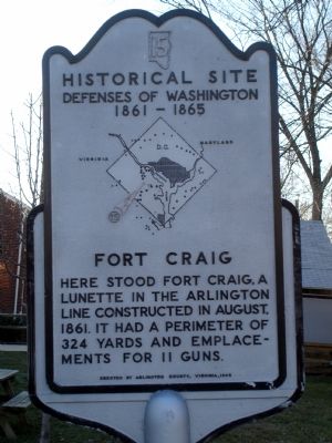
Fort Craig
Historical Site
— Defenses of Washington 1861 - 1865 —
Erected 1965 by Arlington County, Virginia. (Marker Number 15.)
Topics and series. This historical marker is listed in these topic lists: Forts and Castles • War, US Civil. In addition, it is included in the Defenses of Washington series list. A significant historical year for this entry is 1861.
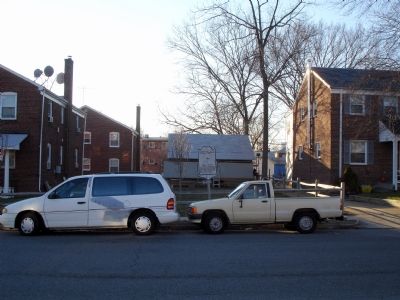
Location. 38° 52.224′ N, 77° 4.899′ W. Marker is in Arlington, Virginia, in Arlington County. It is in Penrose. Marker is at the intersection of South Courthouse Road and South 4th Street, on the right when traveling south on South Courthouse Road. Touch for map. Marker is in this post office area: Arlington VA 22204, United States of America. Touch for directions.
Other nearby markers. At least 8 other markers are within walking distance of this marker. The Arlington Radio Towers (approx. ¼ mile away); Charles Drew House (approx. 0.3 miles away); Argonne Cross (approx. 0.3 miles away); American-Armenian Volunteer Memorial (approx. 0.3 miles away); Lancaster Monument (approx. 0.4 miles away); St. John's Baptist Church (approx. 0.4 miles away); Battle of the Bulge Monument (approx. half a mile away); Spanish-American War Nurses Memorial (approx. half a mile away). Touch for a list and map of all markers in Arlington.
More about this marker. In the center of the marker is a map of the Washington Defenses, with a red (weathered) arrow pointing out the location of Fort Craig.
Additional commentary.
1. Fort Craig Particulars
From Mr. Lincoln's Forts: A Guide to the Civil War Defenses of Washington, by Benjamin Franklin Cooling III and Walton H. Owen II:
The fort was named in honor of Lt. Presley O. Craig, killed at First Bull Run on July 21, 1861. It was constructed in August 1861. The fort covered the Alexandria and Georgetown Road.
Within a perimeter of 324 yards were 11 gun emplacements and two magazines. A quartermaster building stood just outside the fort in a gorge. The armament included four 24-pdr guns, one 24-pdr field howitzer, five 30-pdr Parrotts, one 10-inch mortar, and one 24-pdr Coehorn mortar.
Units garrisoned at the fort included the 1st Massachusetts Heavy Artillery, 138th Ohio Infantry, 6th Pennsylvania Heavy Artillery, and 16th Maine Infantry.
— Submitted February 4, 2008, by Craig Swain of Leesburg, Virginia.
Credits. This page was last revised on February 1, 2023. It was originally submitted on February 4, 2008. This page has been viewed 1,861 times since then and 76 times this year. Photos: 1, 2. submitted on February 4, 2008. 3. submitted on February 9, 2008. • Craig Swain was the editor who published this page.


