Marker Logo HMdb.org THE HISTORICAL
MARKER DATABASE
“Bite-Size Bits of Local, National, and Global History”
Riverton in Cherokee County, Kansas — The American Midwest (Upper Plains)
 

Marsh Rainbow Arch Bridge


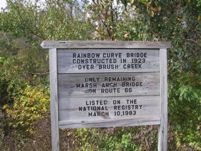
Marsh Rainbow Arch Bridge Marker image. Click for full size.
Photographed By Michael Kindig, October 12, 2008
1. Marsh Rainbow Arch Bridge Marker
Inscription.
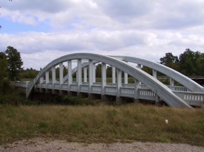
Rainbow Curve Bridge constructed in 1923 over Brush Creek.
Only remaining Marsh Arch Bridge on Route 66.
Listed on the National Registry March 10, 1983.
 
Erected 1923.
 
Topics and series. This historical marker is listed in these topic lists: Bridges & ViaductsRoads & Vehicles. In addition, it is included in the U.S. Route 66 series list. A significant historical date for this entry is March 10, 1913.
 
Location. 37° 4.399′ N, 94° 44.466′ W. Marker is in Riverton, Kansas, in Cherokee County. Marker is on South East Beasley Road, on the right when traveling west. Touch for map. Marker is in this post office area: Riverton KS 66770, United States of America. Touch for directions.
 
Other nearby markers. At least 8 other markers are within 2 miles of this marker, measured as the crow flies. Baxter Springs Massacre (approx. 0.9 miles away); Where Two Roads Converge (approx. 1.3 miles away); Fort Blair (approx. 1.3 miles away); Baxter Springs Massacre and Today (approx. 1.3 miles away); Bridging the American Divide (approx. 1.3 miles away); Boom Towns (approx. 1.3 miles away); Cosmopolitan Corner (approx. 1.3 miles away); Crossroads of Kansas (approx. 1.3 miles away). Touch for a list and map of all markers in Riverton.
 
Related markers. Click here for a list of markers that are related to this marker. Rainbow Arch Bridge in Fort Morgan, CO
 
Also see . . .
Paid Advertisement
Click on the ad for more information.
Please report objectionable advertising to the Editor.
Click or scan to see
this page online
 Brush Creek Rainbow Arch Bridge. National Register of Historic Places Nomination Form (Submitted on February 26, 2015, by William Fischer, Jr. of Scranton, Pennsylvania.) 
 
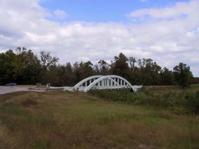
Marsh Rainbow Arch Bridge image. Click for full size.
Photographed By Michael Kindig, October 12, 2008
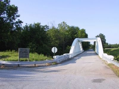
2. Marsh Rainbow Arch Bridge
Marsh Rainbow Arch Bridge Marker image. Click for full size.
Photographed By Michael Kindig, May 21, 2003
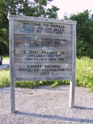
3. Marsh Rainbow Arch Bridge Marker
Welcome to Kansas
Route 66 13.2 miles tying 66 together from Chicago to L.A.
In constant use from 1926-1960
A joint project of Cherokee County Commission and the Kansas Historic Route 66 Association
1994
Marsh Rainbow Arch Bridge image. Click for full size.
Photographed By Michael Kindig, May 21, 2003
4. Marsh Rainbow Arch Bridge
Marsh Rainbow Arch Bridge image. Click for full size.
Photographed By Michael Kindig, May 21, 2003
5. Marsh Rainbow Arch Bridge
Marsh Rainbow Arch Bridge image. Click for full size.
Photographed By Michael Kindig, October 12, 2008
6. Marsh Rainbow Arch Bridge
Marsh Rainbow Arch Bridge image. Click for full size.
Photographed By Michael Kindig, October 12, 2008
7. Marsh Rainbow Arch Bridge
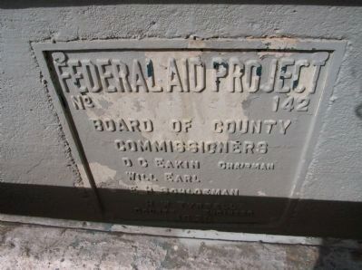
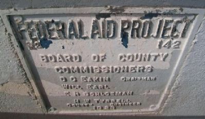
Federal Aid Project No. 142
Board of County Commissioners
D.C. Eakin Chairman • Will Earl • E.H. Schloeman • H.W. Tyrell County Engineer
1923
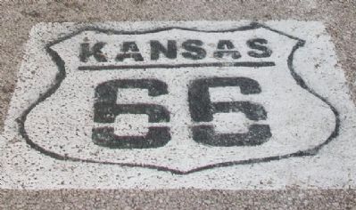
Route 66 Street Marker on Road at Marsh Rainbow Arch Bridge image. Click for full size.
Photographed By William Fischer, Jr., February 21, 2015
8. Route 66 Street Marker on Road at Marsh Rainbow Arch Bridge
Marsh Rainbow Arch Bridge Project Marker image. Click for full size.
Photographed By William Fischer, Jr., February 21, 2015
9. Marsh Rainbow Arch Bridge Project Marker
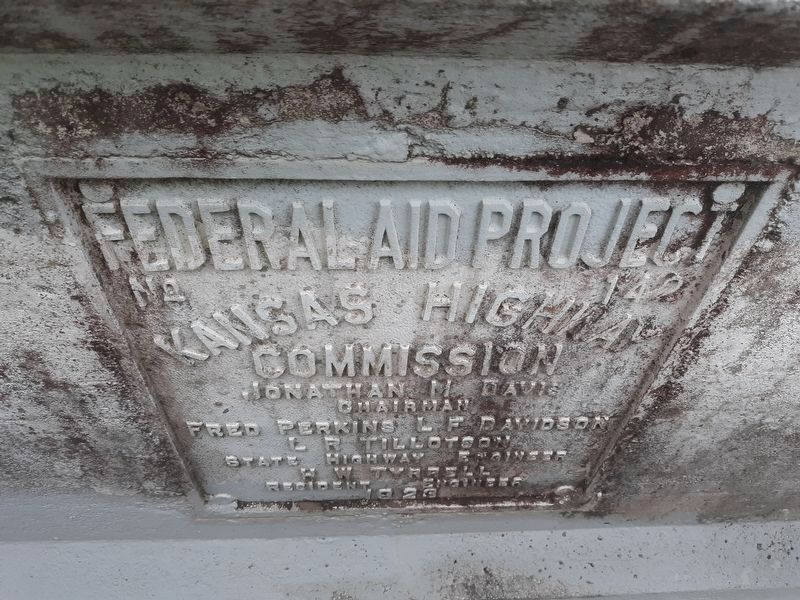
Marsh Rainbow Arch Bridge Marker image. Click for full size.
Photographed By Craig Doda, May 12, 2020
10. Marsh Rainbow Arch Bridge Marker
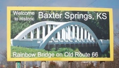
Marsh Rainbow Arch Bridge Welcome Sign image. Click for full size.
Photographed By William Fischer, Jr., February 21, 2015
11. Marsh Rainbow Arch Bridge Welcome Sign
On northbound US Hwy 69 at south end of town
 
 
Credits. This page was last revised on June 23, 2023. It was originally submitted on January 30, 2012, by Michael Kindig of Elk Grove, California. This page has been viewed 1,006 times since then and 37 times this year. Photos:   1, 2, 3, 4, 5, 6, 7. submitted on January 30, 2012, by Michael Kindig of Elk Grove, California.   8, 9. submitted on February 26, 2015, by William Fischer, Jr. of Scranton, Pennsylvania.   10. submitted on December 4, 2020, by Craig Doda of Napoleon, Ohio.   11. submitted on February 26, 2015, by William Fischer, Jr. of Scranton, Pennsylvania. • Bill Pfingsten was the editor who published this page.
Share this page.  
Share on Tumblr
m=52060

CeraNet Cloud Computing sponsors the Historical Marker Database.
This website earns income from purchases you make after using our links to Amazon.com. We appreciate your support.
Paid Advertisement
Apr. 25, 2024