Near Phippsburg in Sagadahoc County, Maine — The American Northeast (New England)
The Casemate Key to a Fort's Design
Inscription.
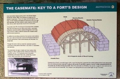
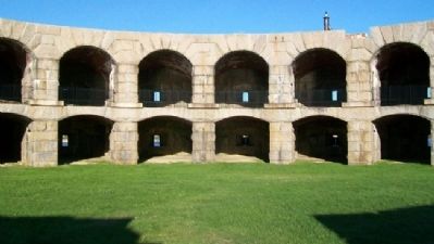
Like most other masonry forts built in the United States during the middle 1800s, Fort Popham is made up of a series of casemates. These are large enclosed spaces with high, arched ceilings and places for cannons to fire through wall openings. All of the nation's major masonry forts built from 1816 to 1867 had at least one level of casements.
Casemates were first developed in European forts centuries ago. By enclosing cannons within thick walls, casemates protected cannons and soldiers firing them. But firing large cannons within confined spaces also created safety and structural problems.
In addition to providing protection for cannons and soldiers, this open style of casemate used in Fort Popham allowed it to have several tiers, thus concentrating the firepower of a single fort.
Though this fort is built as a two-tier casement system, some forts of the period has three and four tiers of casements and cannons.
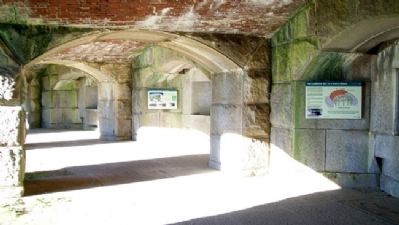
The casemates are open in back and have vents in the ceilings in order to disperse the smoke and noise from firing the cannon. The casemates were not joined structurally to the fort's front wall, so that they would remain intact even if the wall was destroyed.
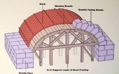
[Main diagram caption reads]
Construction of each casement began with a wood framing that supported the arched ceiling while it was being built. Once the brick and stone were laid in placed [sic] with mortar to hold them together, the arch shape maintained pressure that made the structure strong and stable. Once the casement was finished, the wooden supports were removed and used to build the next casement. This design is so strong that one can be built right on top of another.
Erected by Maine Department of Conservation and Popham 400th.
Topics. This historical marker is listed in these topic lists: Forts and Castles • War, US Civil. A significant historical year for this entry is 1816.
Location. 43° 45.304′ N, 69° 47′ W. Marker is near Phippsburg, Maine, in Sagadahoc County. Marker is on a lower casement (gun deck) wall inside Fort Popham State Historic Site, off Popham Road (Maine Route 209). Touch for map. Marker is in this post office area: Phippsburg ME 04562, United States of America. Touch for directions.
Other nearby markers. At least 8 other markers are within 10 miles of this marker, measured as the crow flies. Fort Popham: Guardian of the Kennebec (here, next to this marker); Firing a Cannon (here, next to this marker); Forts on the Kennebec River (a few steps from this marker); Percival P. Baxter (a few steps from this marker); Sites of Forts in this Area (within shouting distance of this marker); Fort Popham State Historic Site
(about 700 feet away, measured in a direct line); Phippsburg Veterans and Mariners Memorial (approx. 4.2 miles away); The Caulkers' Shed (1899) (approx. 9.8 miles away). Touch for a list and map of all markers in Phippsburg.
Also see . . .
1. Fort Popham State Historic Site. (Submitted on February 1, 2012, by William Fischer, Jr. of Scranton, Pennsylvania.)
2. Fort Popham, Maine. (Submitted on February 1, 2012, by William Fischer, Jr. of Scranton, Pennsylvania.)
Credits. This page was last revised on September 23, 2020. It was originally submitted on February 1, 2012, by William Fischer, Jr. of Scranton, Pennsylvania. This page has been viewed 851 times since then and 39 times this year. Photos: 1, 2, 3, 4. submitted on February 1, 2012, by William Fischer, Jr. of Scranton, Pennsylvania. 5. submitted on January 31, 2012, by William Fischer, Jr. of Scranton, Pennsylvania.
