Lodgepole Village in Tulare County, California — The American West (Pacific Coastal)
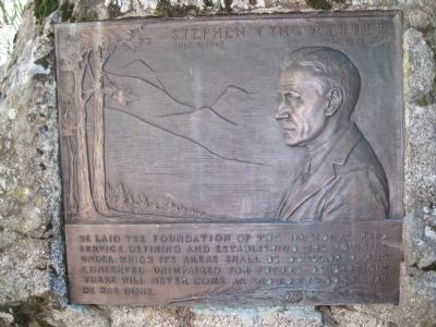
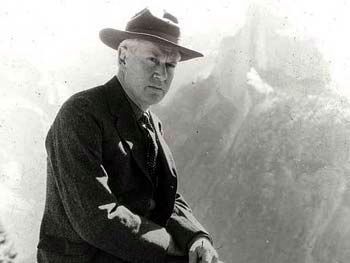
Stephen Tyng Mather
July 4, 1867 Jan: 22, 1930
He laid the foundation of the National Park Service defining and establishing the policies under which its areas shall be developed and conserved unimpaired for future generations. There will never come to an end to the good that he has done.
Topics and series. This historical marker is listed in this topic list: Environment. In addition, it is included in the Stephen Tyng Mather series list.
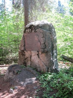
Location. 36° 33.204′ N, 118° 45.684′ W. Marker is in Lodgepole Village, California, in Tulare County. Marker is on Crescent Meadow Road. This marker is found in Sequoia National Park on Crescent Meadow Road, on the left, shortly after passing the Tunnel Log while on the way to Crescent Meadow. Touch for map. Marker is in this post office area: Sequoia National Park CA 93262, United States of America. Touch for directions.
Other nearby markers. At least 8 other markers are within one mile of this marker, measured as the crow flies. The CCC Boys (about 300 feet away, measured in a direct line); Call the Cavalry! (approx. ¼ mile away); Buttress Tree (approx. ¼ mile away); Auto Log (approx. 0.4 miles away); Colonel Young: A Buffalo Soldier (approx. 0.4 miles away); The Naturalists (approx. half a mile away); Middle Fork Canyon (approx. 0.7 miles away); For the Good of the Giants (approx. one mile away).
Regarding Stephen Tyng Mather. A duplicate of the Stephen Tyng Mather marker is located in the University of California Berkeley Botanical Gardens' Redwood Grove on Centennial Drive (approximately 37.875099N, 122.239199W).
Related marker. Click here for another marker that is related to this marker.
Additional keywords. National Parks
Credits. This page was last revised on October 23, 2023. It was originally submitted on July 7, 2011, by Barry Swackhamer of Brentwood, California. This page has been viewed 712 times since then and 15 times this year. Last updated on February 15, 2012, by Barry Swackhamer of Brentwood, California. Photos: 1. submitted on July 7, 2011, by Barry Swackhamer of Brentwood, California. 2. submitted on October 16, 2020, by Larry Gertner of New York, New York. 3. submitted on July 7, 2011, by Barry Swackhamer of Brentwood, California. • Syd Whittle was the editor who published this page.


