Anacostia in Southeast Washington in Washington, District of Columbia — The American Northeast (Mid-Atlantic)
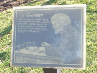
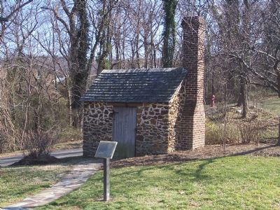
The Growlery
Inscription.
Here stood Frederick Douglassí rustic retreat from domestic society, where he could think, read and write undisturbed. Evoking the image of a lionís lair, he called his hideaway the Growlery. It was simply furnished with a lounge, a high desk and a stool. The present building is a reconstruction.
Erected by National Park Service, U.S. Department of the Interior.
Topics. This historical marker is listed in these topic lists: African Americans • Arts, Letters, Music • Civil Rights.
Location. This marker has been replaced by another marker nearby. It was located near 38° 51.766′ N, 76° 59.108′ W. Marker was in Southeast Washington in Washington, District of Columbia. It was in Anacostia. Marker could be reached from W Street Southeast east of 14th Street Southeast, on the right when traveling east. Marker was part of the Frederick Douglass National Historic Site. Touch for map. Marker was at or near this postal address: 1411 W Street Southeast, Washington DC 20020, United States of America. Touch for directions.
Other nearby markers. At least 8 other markers are within walking distance of this location. Frederick Douglass's Rustic Retreat (a few steps from this marker); Frederick Douglass National Historic Site (within shouting distance of this marker); The Sage of Anacostia (about 500 feet away, measured in a direct line); Uniontown, DC's First Suburb (approx. 0.2 miles away); Mother Churches and Their Daughters (approx. 0.2 miles away); Rose's Row (approx. ľ mile away); Education Matters (approx. ľ mile away); Transit and Trade (approx. 0.3 miles away). Touch for a list and map of all markers in Southeast Washington.
Related marker. Click here for another marker that is related to this marker. This marker has been replaced with the linked marker.
Additional keywords. Reconstruction, 19th Century
Credits. This page was last revised on March 31, 2024. It was originally submitted on February 13, 2008, by Richard E. Miller of Oxon Hill, Maryland. This page has been viewed 3,042 times since then and 18 times this year. Photos: 1, 2. submitted on February 13, 2008, by Richard E. Miller of Oxon Hill, Maryland. • J. J. Prats was the editor who published this page.

