Near Boswells Tavern in Louisa County, Virginia — The American South (Mid-Atlantic)
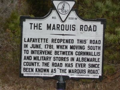
The Marquis Road
Erected 1928 by Virginia Conservation and Development Commission. (Marker Number W-206.)
Topics and series. This historical marker is listed in these topic lists: Roads & Vehicles • War, US Revolutionary. In addition, it is included in the Virginia Department of Historic Resources (DHR) series list. A significant historical month for this entry is June 1781.
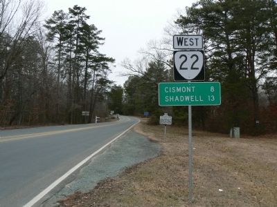
Location. 38° 4.269′ N, 78° 11.183′ W. Marker is near Boswells Tavern, Virginia, in Louisa County. Marker is at the intersection of The Marquis Road (Virginia Route 22) and James Madison Highway (U.S. 15), on the right when traveling west on The Marquis Road. Touch for map. Marker is at or near this postal address: 4332 James Madison Hwy, Gordonsville VA 22942, United States of America. Touch for directions.
Other nearby markers. At least 8 other markers are within 5 miles of this marker, measured as the crow flies. Civilian Conservation Corps Company 2347 (about 300 feet away, measured in a direct line); Boswell’s Tavern (approx. 0.2 miles away); Albemarle County / Louisa County (approx. 3.8 miles away); Orange County / Louisa County (approx. 3.9 miles away); General Thomas Sumter (approx. 4.1 miles away); Campaign of 1781 (approx. 4.1 miles away); Green Springs (approx. 4.2 miles away); In Memory of the Soldiers, Both Confederate and Union (approx. 4.2 miles away). Touch for a list and map of all markers in Boswells Tavern.
Regarding The Marquis Road. This marker refers to part of the key role that the Marquis de Lafayette played in the military maneuvers that led to the surrender of the British at Yorktown, Virginia on October 17, 1781, sealing the victory of the American Revolution.
Additional keywords. 1781 Battle of Yorktown, France,
Credits. This page was last revised on April 4, 2021. It was originally submitted on February 14, 2008, by Franklin Bell of Bluemont, Virginia. This page has been viewed 1,485 times since then and 67 times this year. Photos: 1, 2. submitted on February 14, 2008, by Franklin Bell of Bluemont, Virginia. • Craig Swain was the editor who published this page.

