Northside in Berkeley in Alameda County, California — The American West (Pacific Coastal)
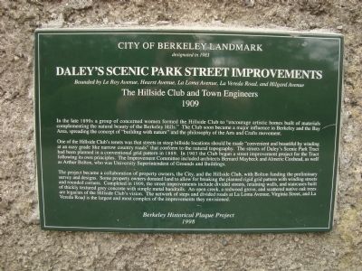
Daley’s Scenic Park Street Improvenents
Bounded by Le Roy Avenue, La Loma Avenue, La Vereda Road and Hilgard Avenue
— The Hillside Club and Town Engineers; 1909 —
designated in 1983
One of the Hillside Club’s tenets was that streets in steep hillside locations should be “convenient and beautiful by winding at and easy grade like narrow country roads” that conform to the natural topography. The streets of Daley’s Scenic Park Tract had been planned in a conventional grid pattern in 1889. In 1903 the Club began a street improvement project for the Tract following its own principles. The Improvement Committee included architects Bernard Maybeck, and Almeric Coxhead, as well as Arthur Bolton, who was University Superintendent of Grounds and Buildings.
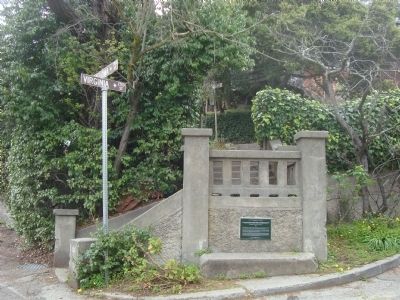
The project became a collaboration of property owners, the City and the Hillside Club, with Bolton funding the preliminary survey and design. Some property owners donated land to allow for breaking the planned grid pattern with winding streets and rounded corners. Completed in 1909, the street improvements include divided streets, retaining walls, and staircases built of thickly textured grey concrete with simple metal handrails. An open creek, a redwood grove, and scattered native oak trees are legacies of the Hillside Club’s vision. The network of steps and divided roads at La Loma Avenue, Virginia Street, and La Vereda Road is the largest and most complex of the improvements they invisioned.
Erected 1998 by Berkeley Historical Plaque Project.
Topics. This historical marker is listed in this topic list: Environment. A significant historical year for this entry is 1983.
Location. 37° 52.697′ N, 122° 15.424′ W. Marker is in Berkeley, California, in Alameda County. It is in Northside. Marker is at the intersection of La Loma Avenue and Virginia Street on La Loma Avenue. Touch for map. Marker is at or near this postal address: 1700 La Loma Avenue, Berkeley CA 94708, United States of America. Touch for directions.
Other nearby markers. At least 8 other markers are within walking distance of this marker. Jensen House (within shouting distance of this marker); Allenoke Manor (about 700 feet away, measured in a direct line); "Annie's Oak" (about 800 feet away); Cloyne Court Hotel (approx. 0.2 miles away); Robert Hale Merriman Residence (approx. 0.2 miles away); Temple of Wings (approx. 0.2 miles away); Annie and Bernard Maybeck House (approx. 0.2 miles away); Hillside School (approx. ¼ mile away). Touch for a list and map of all markers in Berkeley.
Also see . . . The Hillside Club - history. The Hillside Club was founded by a group of Berkeley women who wished to protect the Berkeley hillsides by promoting the development of the community in environmentally sensitive ways. (Submitted on March 25, 2012, by Barry Swackhamer of Brentwood, California.)
Credits. This page was last revised on February 7, 2023. It was originally submitted on March 25, 2012, by Barry Swackhamer of Brentwood, California. This page has been viewed 661 times since then and 20 times this year. Photos: 1, 2. submitted on March 25, 2012, by Barry Swackhamer of Brentwood, California. • Syd Whittle was the editor who published this page.

