Sedona in Coconino County, Arizona — The American Mountains (Southwest)
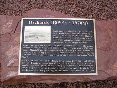
Orchards (1890 - 1970)
Apples and peaches became the primary orchard crops. The Jordan orchard flanked both sides of this street and grew to almost 1500 fruit trees. Flagstaff and the mining town of Jerome provided markets for fruit, as did far away places. Oak Creek fruit was shipped to Seattle, San Francisco, Minnesota and even to American troops during World War II.
Before the Jordans, the Pendleys, Thompsons, Purtymuns, and others developed orchards along Oak Creek. Henry Schuerman grew apples, peaches, apricots, pears, quinces and grapes complete with a vineyard for making wines in the German style of his heritage. Roadside fruit stands popped up along the canyon road after it was paved in the 1930.
Topics. This historical marker is listed in this topic list: Agriculture. A significant historical year for this entry is 1500.
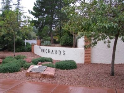
Location. 34° 52.648′ N, 111° 45.662′ W. Marker is in Sedona, Arizona, in Coconino County. Marker is at the intersection of Jordan Road and Orchard Lane, on the right when traveling south on Jordan Road. Touch for map. Marker is at or near this postal address: 729 Jordan Road, Sedona AZ 86336, United States of America. Touch for directions.
Other nearby markers. At least 8 other markers are within walking distance of this marker. Jordan Farmhouse (about 500 feet away, measured in a direct line); Van Deren Ranch (about 500 feet away); Fruit Packing House (about 600 feet away); Jordan Tractor Shed (about 700 feet away); Jordan Sales Building (approx. 0.4 miles away); Rollie's Camera (approx. half a mile away); Carl Richards' Garage (approx. half a mile away); The Sinagua (approx. 0.7 miles away). Touch for a list and map of all markers in Sedona.
Credits. This page was last revised on June 16, 2016. It was originally submitted on April 8, 2012, by Denise Boose of Tehachapi, California. This page has been viewed 910 times since then and 44 times this year. Photos: 1, 2, 3. submitted on April 8, 2012, by Denise Boose of Tehachapi, California. • Syd Whittle was the editor who published this page.


