Daniels Hill in Lynchburg, Virginia — The American South (Mid-Atlantic)
Point of Honor
Spies in Lynchburg
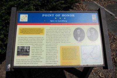
Owen’s wife, Narcissa, was the daughter of a Cherokee chief. She headed the local Soldiers Aid Society that made uniforms, knapsacks, and other items for Confederate soldiers. Before the Battle of Lynchburg, two men calling themselves Confederates appeared at Point of Honor asking for food. Narcissa Owen told them that there were 20,000 Confederates in the city to boost their morale, and that they would “give the Yanks fits” in the morning. The men, however, were really Union Gen. David Hunter’s spies, and her exaggeration may have helped convince Hunter to retreat on June 18. In Kansas after the war, Owen first learned from her housekeeper that the men were Union spies—one of them the housekeeper’s father.
(sidebar)
On May 26, 1864, Union Gen. David Hunter marched south from Cedar Creek near Winchester to dive out Confederate forces, lay waste to the Shenandoah Valley, and destroy transportation facilities at Lynchburg. His raid was part of Gen. Ulysses S. Grant’s strategy to attack Confederates simultaneously throughout Virginia. After defeating Gen. William E. “Grumble” Jones at Piedmont on June 5, Hunter marched to Lexington, burned Virginia Military Institute, and headed to Lynchburg. Here, on June 17-18, Gen. Jubal A. Early repulsed Hunter and pursued him to West Virginia. Early then turned north in July to threaten Washington.
(sidebar)
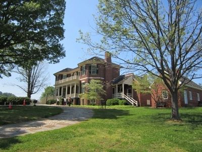
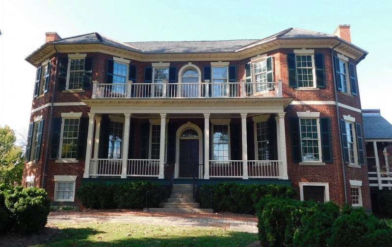
Built by Dr. George Cabell, Sr., in 1815, this refined, Federal-style dwelling is stylistically linked to houses in Richmond. The source of the name is not known, but local legend suggests that duels were fought here. Cabell owned vast properties in Virginia, including this 737-acre plantation and a nearby tobacco warehouse where batteaux were loaded and goods shipped to Richmond on the James River. Point of Honor was restored and opened to the public in 1977 as part of the Lynchburg Museum System. All photographs are courtesy of Lynchburg Museum System
Erected by Virginia Civil War Trails.
Topics and series. This historical marker is listed in this topic list: War, US Civil. In addition, it is included in the Virginia Civil War Trails series list. A significant historical month for this entry is June 1925.
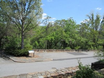
Location. 37° 25.243′ N, 79° 8.591′ W. Marker is in Lynchburg, Virginia. It is in Daniels Hill. Marker is at the intersection of Norwood Street and A Street, on the right when traveling north on Norwood Street. Touch for map. Marker is at or near this postal address: 112 Cabell Street, Lynchburg VA 24504, United States of America. Touch for directions.
Other nearby markers. At least 8 other markers are within walking distance of this marker. Allen Weir Freeman, M.D. (approx. 0.2 miles away); Douglas Southall Freeman (approx. 0.2 miles away); Lynchburg History (approx. 0.2 miles away); The Academy of Music (1905-1958) (approx. 0.2 miles away); The Ladies Relief Hospital (approx. ¼ mile away); a different marker also named The Ladies Relief Hospital (approx. ¼ mile away); a different marker also named Lynchburg History (approx. ¼ mile away); Williams Viaduct (approx. 0.3 miles away). Touch for a list and map of all markers in Lynchburg.
More about this marker. On the lower left is an "Early photo of Point of Honor". On the right are portraits of "Robert Owen" & "Narcissa Owen". On the lower right is a map of Hunter's Raid.
Also see . . .
1. Southside Virginia Civil War - Lynchburg. Virginia Civil War Trails (Submitted on April 13, 2012.)
2. Point of Honor, Lynchburg, Virginia. (Submitted on April 13, 2012.)
3. Point of Honor. National Register of Historic Places (Submitted on November 9, 2021.)
Credits. This page was last revised on February 1, 2023. It was originally submitted on April 13, 2012, by Bernard Fisher of Richmond, Virginia. This page has been viewed 660 times since then and 15 times this year. Photos: 1, 2, 3. submitted on April 13, 2012, by Bernard Fisher of Richmond, Virginia. 4. submitted on March 18, 2021, by Bradley Owen of Morgantown, West Virginia.


