Machias in Washington County, Maine — The American Northeast (New England)
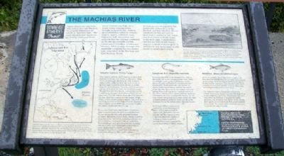
The Machias River
Downeast Fisheries Trail
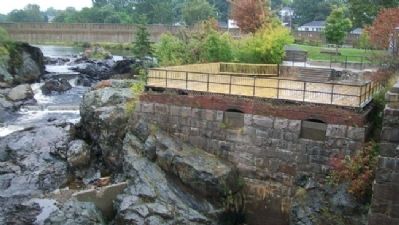
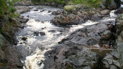
Native Americans called the falls next to this sign Machias, the popular translation of which is "bad little falls." The name Machias now applies to the nearby towns and rivers. South of Bad Little Falls, river water mixes with sea water brought in by each tide, making an environment called an estuary. Eagles, osprey, softshell clams, migratory fish, shorebirds and seabirds find the varying conditions of the estuary suitable habitat. Upstream, a vast array of tributary streams, lakes, ponds, swamps and peatlands comprise the 810 square mile watershed of the Machias and East Machias Rivers.
Several species of migratory fish spend part of their lives in the Machias and East Machias Rivers. Anadromous fish are born in fresh water, mature in salt water, and then return to fresh water to lay their eggs. Catadromous species are born in salt water, migrate to fresh water to grow to adulthood, and then return to the ocean to spawn their young.
Atlantic salmon, Salmo solar
Wild Atlantic salmon, once common in most New England rivers, are now found in only a few Maine rivers, including the Machias. In early summer, salmon swim upstream from the open ocean to lay their eggs in gravely beds, known as redds, along the river's bottom. Once hatched, the growing parr are at home in the river for about two years. The parr then become smolts, undergoing a series of biological changes which allow them to live in salt water. The fish migrate down the river and into the sea. After two years at sea the mature adults return to their home rivers to spawn. The odds of surviving all of these life stages is small. Research shows that for every 8000 eggs spawned, roughly two adults reach reproductive age.
Fewer and fewer wild salmon have returned to Maine's rivers during the past several decades. No one knows for sure why populations have declined. Alteration of river beds, human activities along the river and at sea, natural predators, and environmental conditions could all be factors. The federal and state governments are working with the public to invest in salmon hatcheries, water quality improvements, and land management plans to ensure that wild salmon continue to return to their native rivers.
American Eel Anguilla rostrata
American eels born in the Sargasso Sea drift as larva with the ocean currents toward land. Some are brought north by the Gulf Stream. As the larval eggs approach land, their bodies become transparent. These glass eels, also known as elvers, swim into estuaries, such as the mouth of the Machias River, in the late winter and early spring. Some eels stay in the brackish waters of the lower estuary, while others swim far upstream and inland.
Once in a comfortable habitat, an eel may remain for as long as 25 years before the urge to spawn sends it down the river and out to the Sargasso Sea in the middle of the Atlantic Ocean.
In the late 1900s a commercial market for elvers developed in Maine. Using funnel-shaped "fyke" nets, fishermen harvest the tiny fish for export to Asia. Concerns about the impact of fishing on these long-lived animals led to state regulations on eel harvesting in Maine waters.
Alewives Alosa pseudoharengus
Alewives are little silvery fish which return to the East Machias and Machias Rivers each year to spawn. In the ocean, alewives migrate between the Bay of Fundy and the Carolinas. They usually reach sexual maturity at four years and live to be as old as nine, spawning as many as five or six times.
For centuries Native Americans, followed by settlers from away, dipped out nets full of alewives as they migrated upstream. The plentiful fish were used either as fertilizer or smoked for eating. Alewives still return to most Maine rivers, though their numbers have declined. Few people harvest them today. The return of the alewives each year is a welcome sign of spring.
Visit other sites on the Downeast Fisheries Trail in Milbridge, Lubec and at Cobscook Bay.
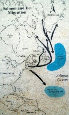
[Map caption reads]
Atlantic salmon from rivers in Maine migrate
north as far as Greenland and winter off Newfoundland, often sharing feeding grounds with their European relations. American eels found along the eastern seaboard of the United States were born thousands of miles away in an area of the central Atlantic Ocean known as the Sargasso Sea.
[Photo caption reads]
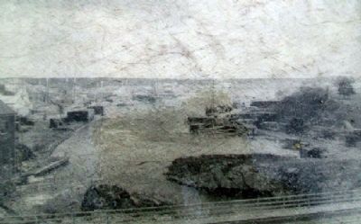
Starting in the 1700s, settlers built waterpowered mills at Bad Little Falls to turn raw logs floated down the Machias River into lumber. As shown in this photo, wharves below the falls were stacked high with lumber to be loaded onto waiting vessels. Given the abundance of lumber, it was logical that Machias residents turned to shipbuilding as well. Using the falls for power often impeded upstream access for migratory fish.
Topics. This historical marker is listed in these topic lists: Animals • Industry & Commerce • Waterways & Vessels.
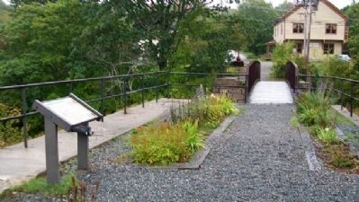
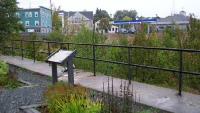
Location. 44° 42.817′ N, 67° 27.467′ W. Marker is in Machias, Maine, in Washington County. Marker is on the viewing platform near Bad Little Falls, between U.S. 1 and Elm Street (Maine Route 92). Touch for map. Marker is in this post office area: Machias ME 04654, United States of America. Touch for directions.
Other nearby markers. At least 8 other markers are within 4 miles of this marker, measured as the crow flies. First Permanent English Settlement in Machias Bay (about 500 feet away, measured in a direct line); Burnham Tavern (about 500 feet away); Veterans Memorial (about 500 feet away); First Naval Battle of the American Revolution (about 600 feet away); World War I Memorial (about 600 feet away); Libby Hall (approx. ¼ mile away); Fort Machias/O'Brien (approx. 3.4 miles away); Birthplace of the U.S. Navy (approx. 3.4 miles away). Touch for a list and map of all markers in Machias.
Credits. This page was last revised on June 16, 2016. It was originally submitted on April 22, 2012, by William Fischer, Jr. of Scranton, Pennsylvania. This page has been viewed 901 times since then and 33 times this year. Photos: 1, 2, 3, 4, 5, 6, 7. submitted on April 22, 2012, by William Fischer, Jr. of Scranton, Pennsylvania.
