Palmyra in Marion County, Missouri — The American Midwest (Upper Plains)
Palmyra
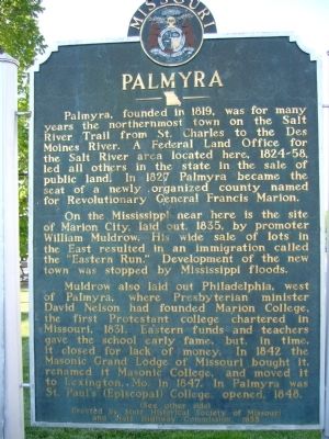
Palmyra, founded in 1819, was for many years the northernmost town on the Salt River Trail from St. Charles to the Des Moines River. A Federal Land Office for the Salt River area located here, 1824 – 58, led all others in the state in the sale of public land. In 1827 Palmyra became the seat of a newly organized county named for Revolutionary General Francis Marion.
On the Mississippi near here is the site of Marion City, laid out, 1835, by promoter William Muldrow. His wide sale of lots in the East resulted in an immigration called the “Eastern Run.” Development of the new town was stopped by Mississippi floods.
Muldrow also laid out Philadelphia, west of Palmyra, where Presbyterian minister David Nelson had founded Marion College, the first Protestant college chartered in Missouri, 1831. Eastern funds and teachers gave the school early fame, but, in time, it closed for lack of money. In 1842 the Masonic Grand Lodge of Missouri bought it, renamed it Masonic College, and moved it to Lexington, MO. in 1847. In Palmyra was St. Paul’s (Episcopal) College, opened, 1848.
Side B:
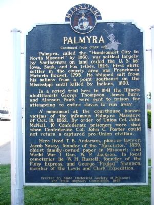
Palmyra, called the “Handsomest City in North Missouri” by 1860, was settled largely by Southerners on land ceded by the U.S. by Iowa, Sauk, and Fox tribes, 1824. First white settler in the county area was Frenchman Maturin Bouvet, 1795. He shipped salt from his salines from a point southeast on the Mississippi until killed by Indians, 1800.
In a noted trial here in 1841 the Illinois abolitionists George Thompson, James Burr, and Alanson Work were sent to prison for attempting to entice slaves to run away.
A monument at the courthouse honors victims of the infamous Palmyra Massacre of October 18, 1862. By order of Union Col. John McNeil, 10 Confederate prisoners were shot when Confederate Col. John C. Porter could not return a captured pro-Union civilian.
Here lived T.B. Anderson, pioneer lawyer; Jacob Sosey, founder of the “Spectator,” 1839, oldest family-owned paper in Missouri; and World War I General W.P. Jackson. In local cemeteries lie W.H. Russell, founder of the Pony Express, and George “Pegleg” Shannon, member of the Lewis and Clark Expedition.
Erected 1955 by State Historical Society of Missouri and State Highway Commission.
Topics and series. This historical marker is listed in these topic lists: Settlements & Settlers • War, US Civil. In addition, it is included in the Missouri, The State Historical Society of series list. A significant historical date for this entry is October 18, 1763.
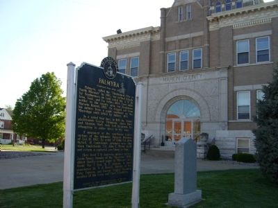
Location. 39° 47.958′ N, 91° 31.396′ W. Marker is in Palmyra, Missouri, in Marion County. Marker is on South Main Street, on the right when traveling south. Marker is in front of Marion County Court House. Touch for map. Marker is at or near this postal address: 100 South Main Street, Palmyra MO 63461, United States of America. Touch for directions.
Other nearby markers. At least 8 other markers are within walking distance of this marker. George Shannon (here, next to this marker); Palmyra Confederate Monument (within shouting distance of this marker); Palmyra Massacre (about 400 feet away, measured in a direct line); Big Spring (about 600 feet away); Speigle House (approx. 0.2 miles away); Gardner House (approx. 0.2 miles away); Potawatomi Emigration (approx. ¼ mile away); Home of Jane Darwell (approx. 0.8 miles away). Touch for a list and map of all markers in Palmyra.
Credits. This page was last revised on June 16, 2016. It was originally submitted on May 15, 2012, by Bill Kirchner of Tucson, Arizona. This page has been viewed 742 times since then and 55 times this year. Photos: 1, 2, 3. submitted on May 15, 2012, by Bill Kirchner of Tucson, Arizona. • Craig Swain was the editor who published this page.


