Buchanan in Botetourt County, Virginia — The American South (Mid-Atlantic)
Buchanan Bridge
An Artillery Duel Ensued
ó Hunterís Raid ó
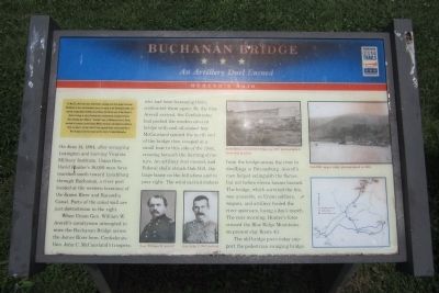
On May 26, 1864, Union Gen. David Hunter marched south from Cedar Creek near Winchester to drive out Confederate forces, lay waste to the Shenandoah Valley, and destroy transportation facilities at Lynchburg. His raid was part of Gen. Ulysses S. Grantís strategy to attack Confederates simultaneously throughout Virginia. After defeating Gen. William E. “Grumble” Jones at Piedmont on June 5, Hunter marched to Lexington, burned Virginia Military Institute, and headed to Lynchburg. There, on June 17-18, Gen. Jubal A. Early repulsed Hunter and pursued him to West Virginia. Early then turned north in July to threaten Washington.
(marker text)
On June 14, 1864, after occupying Lexington and burning Virginia Military Institute, Union Gen. David Hunterís 18,000-man force marched south toward Lynchburg through Buchanan, a river port located at the western terminus of the James River and Kanawha Canal. Parts of the canal wall are just downstream to the right.
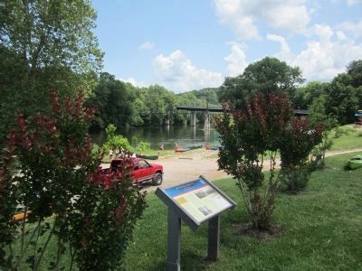
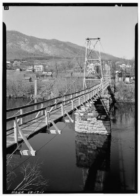
When Union Gen. William W. Averellís cavalrymen attempted to seize the Buchanan Bridge across the James River here, Confederate Gen. John C. McCauslandís troopers, who had been harassing them, confronted them again. By the time Averell arrived, the Confederates had packed the wooden covered bridge with coal oil-soaked hay. McCausland ignited the north end of the bridge then escaped in a small boat to this side of the river, crossing beneath the burning structure. An artillery duel ensued, and Federal shells struck Oak Hill, the large house on the hill above and to your right. The wind carried embers from the bridge across the river to dwellings in Pattonsburg. Averellís men helped extinguish the flames, but not before eleven houses burned. The bridge, which survived the fire, was unusable, so Union soldiers, wagons, and artillery forded the river upstream, losing a dayís march. The next morning, Hunterís force crossed the Blue Ridge Mountains on present-day Route 43.
The old bridge piers today support the pedestrian swinging bridge.
Erected by Virginia Civil War Trails.
Topics and series. This historical marker is listed in this topic list: War, US Civil. In addition, it is included in the Virginia Civil War Trails series list. A significant historical month for this entry is May 1936.
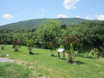
Location. 37° 31.788′ N, 79° 40.776′ W. Marker is in Buchanan, Virginia, in Botetourt County. Marker can be reached from Lowe Street (County Road T-1305) west of Main Street (U.S. 11), on the right when traveling west. Located in the parking lot near Twin River Outfitters. Touch for map. Marker is at or near this postal address: 635 Lowe Street, Buchanan VA 24066, United States of America. Touch for directions.
Other nearby markers. At least
8 other markers are within walking distance of this marker. Buchanan & The James River & Kanawha Canal (a few steps from this marker); 19857 Main Street (about 300 feet away, measured in a direct line); A Bridge Over Time (about 400 feet away); 19827 Main Street (about 400 feet away); Kemble Building (about 400 feet away); 19806 Main Street (about 500 feet away); 19785 Main Street (about 600 feet away); 19781 Main Street (about 600 feet away). Touch for a list and map of all markers in Buchanan.
More about this marker. On the lower left are photographs of "Gen. William W. Averell" and "Gen. John C. McCausland"
On the upper right are photographs with the captions, "Demolition of covered bridge, ca. 1897. photographed from this position." and "Oak Hill, upper right, photographed in 1885."
On the lower right is a Virginia Civil War Trails map of Hunter's Raid.
Credits. This page was last revised on June 16, 2016. It was originally submitted on May 29, 2012, by Bernard Fisher of Richmond, Virginia. This page has been viewed 1,041 times since then and 62 times this year. Photos: 1, 2, 3, 4. submitted on May 29, 2012, by Bernard Fisher of Richmond, Virginia.


