Summit Hall Farm Smokehouse
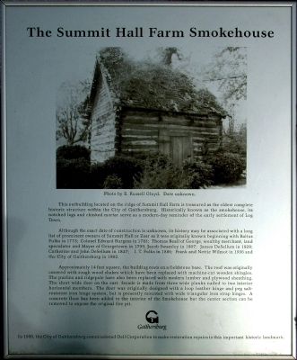
Although the exact date of construction is unknown, its history may be associated with a long list of prominent owners of Summit Hall or Zoar as it was originally known beginning with Baltus Fulks in 1773; Colonel Edward Burgess in 1783; Thomas Beall of George, wealthy merchant, land speculator and Mayor of Georgetown in 1799; Jacob Swamky in 1807; James DeSellum in 1828; Catherine and John DeSellum in 1847; I. T. Fulks in 1886; Frank and Nettie Wilmot in 1936 and the City of Gaithersburg in 1982.
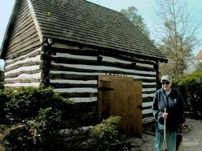
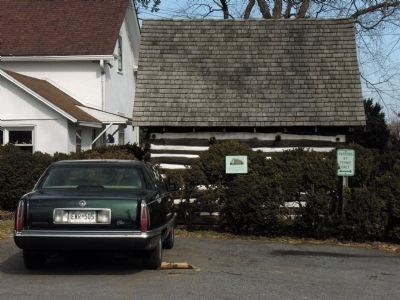
Approximately 14 feet square, the building rests on a fieldstone base. The roof was originally covered with rough wood shakes which have been replaced with machine cut wooden shingles. The purlins and ridgepole have also been replaced with modern lumber and plywood sheathing. The short wide door on the east facade is made from three wide planks nailed to two interior horizontal members. The door was originally designed with a loop leather hinge and peg salt-resistent iron hinge system, but is presently mounted with wide triangular iron strap hinges.
A concrete floor has been added to the interior of the Smokehouse but the center section can be removed to expose the original fire pit.
In 1990, the City of Gaithersburg commissioned Dell Corporation to make restoration repairs to this important historic landmark.
Erected by City of Gaithersburg.
Topics. This historical marker is listed in these topic lists: Agriculture • Notable Buildings. A significant historical year for this entry is 1773.
Location. 39° 7.992′ N, 77° 11.577′ W. Marker is in Gaithersburg, Maryland, in Montgomery County. Marker can be reached from South Frederick Avenue (Maryland Route 355) 0.1 miles north of Fairbanks Drive, on the left when traveling north. Located in Bohrer Park. Touch for map. Marker is at or near this postal address: 506 South Frederick Avenue, Gaithersburg MD 20877, United States of America. Touch for directions.
Other nearby markers. At least 8 other markers are within walking distance of this marker. Summit Hall Farm (within shouting distance of this marker); Gaithersburg (within shouting distance of this marker); DeSellum Family Cemetery (about 800 feet away, measured in a direct line); General Edward Braddock (approx. 0.4 miles away); Meridian Mark Pier and Geodetic Survey Monuments (approx. 0.4 miles away); History and Purpose of the Gaithersburg Latitude Observatory
Credits. This page was last revised on September 22, 2019. It was originally submitted on July 18, 2012, by Allen C. Browne of Silver Spring, Maryland. This page has been viewed 716 times since then and 46 times this year. Photos: 1, 2, 3. submitted on July 18, 2012, by Allen C. Browne of Silver Spring, Maryland. • Bill Pfingsten was the editor who published this page.


