Near Hancock in Washington County, Maryland — The American Northeast (Mid-Atlantic)
National Pike Toll House
Circa 1822
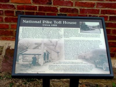
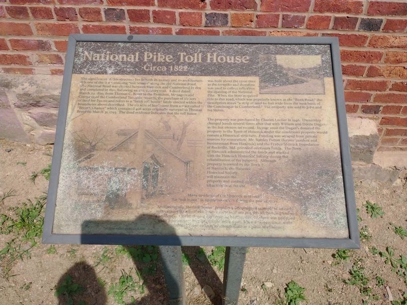
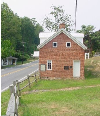
The significance of this structure lies both in its history and architecture. It is one of the few remaining “toll houses” along the old National Road. The National Road was chartered between Hancock and Cumberland in 1819 and completed in 1822, following an 18th century trail. A deed dated March 29, 1820, from Thomas C. Brent to the President, Managers and Company of the Cumberland Turnpike, records the purchase of ˝ acre of land for $50.00 and refers to a “brick toll house lately erected within the boundaries above described.” The ˝ acre of land came from a tract called “Brent’s Chance” which contained 406 acres originally surveyed to Thomas Brent on March 31, 1793. The deed evidence indicates that the toll house was built around the same time as the turnpike and therefore was used to collect tolls since the opening of the National Pike. When the State acquired title to this road, which was popularly known as the “Bank Road,” the description states “a strip of land 60 feet wide from he west bank of the Concheague to Cumberland.” The property was sold to John and Iva Shives.
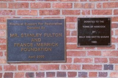
The property was purchased by Charles Locher in 1946. Ownership changed hands several times after that with William and Dottie Dugan as the last owners of record. In the year 2000 the Dugan’s donated the property to the Town of Hancock under the conditions that the property would remain a Historical structure. Mr. Stanley Fulton (former resident and businessman from Hancock) and the France/Merrick Foundation of Rockville, Md., provided the necessary funds. The Town of Hancock administered the funds and worked with the Hancock Historical Society during the rehabilitation of the property. Although property is owned by the Town of Hancock, the Hancock Historical Society will maintain the property and control all activities at the site.
Many residents of the Hancock area recall the “toll house” in operation earlier during the past century.
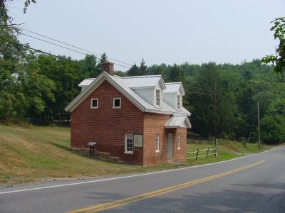
Architecturally the “toll house” provides a documented example of an early 19th century structure which has a combined use as a service building and a residence. Unlike present-day turnpike booths, this structure was equipped to be a permanent dwelling for the toll keeper. Thus its appearance, while functional, also reflects its intended use as a place of residence.
Topics and series. This historical marker is listed in these topic lists: Roads & Vehicles • Settlements & Settlers. In addition, it is included in the The Historic National Road series list. A significant historical date for this entry is March 29, 1966.
Location. 39° 41.921′ N, 78° 12.151′ W. Marker is near Hancock, Maryland, in Washington County. Marker is at the intersection
of Western Pike (Maryland Route 144) and Locker Road, on the left when traveling east on Western Pike. Touch for map. Marker is at or near this postal address: 5143 Western Pike, Hancock MD 21750, United States of America. Touch for directions.
Other nearby markers. At least 8 other markers are within walking distance of this marker. Tonoloway Fort (within shouting distance of this marker); “Old Mr. Flint’s” Home (approx. 0.2 miles away); In Memory Of All Vietnam Veterans (approx. 0.7 miles away); In Memory Of All Persian Gulf War Veterans (approx. 0.7 miles away); In Memory Of All Korean War Veterans (approx. 0.7 miles away); In Memory Of All World War II Veterans (approx. 0.7 miles away); United States Civil War Memorial (approx. 0.7 miles away); In Memory Of All World War I Veterans (approx. 0.7 miles away). Touch for a list and map of all markers in Hancock.
Also see . . . Maryland's Bank Road. (Submitted on September 1, 2006.)
Additional keywords. tollhouse
Credits. This page was last revised on August 10, 2022. It was originally submitted on September 1, 2006, by J. J. Prats of Powell, Ohio. This page has been viewed 2,816 times since then and 77 times this year. Last updated on February 28, 2008, by Christopher Busta-Peck of Shaker Heights, Ohio. Photos: 1. submitted on September 1, 2006, by J. J. Prats of Powell, Ohio. 2. submitted on August 7, 2022, by Craig Doda of Napoleon, Ohio. 3, 4, 5. submitted on September 1, 2006, by J. J. Prats of Powell, Ohio. 6. submitted on February 19, 2008, by Christopher Busta-Peck of Shaker Heights, Ohio. • Craig Swain was the editor who published this page.
