Near Hinesville in Liberty County, Georgia — The American South (South Atlantic)
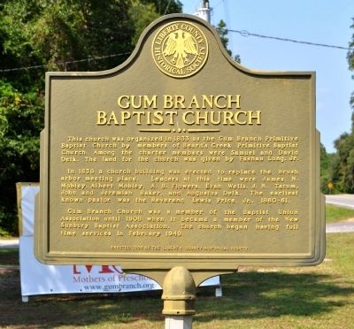
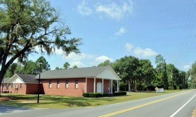
Gum Branch Baptist Church
In 1838 a church building was erected to replace the brush arbor meeting place. Leaders at this time were James N. Mobley, Albert Mobley, A. B. Flowers, Evan Wells, J. N. Tatum, John and Jeremiah Baker, and Augustus Delk. The earliest known pastor was the Reverend Lewis Price, Jr., 1860- 61.
Gum Branch Church was a member of the Baptist Union Association until 1908 when it became a member of the New Sunbury Baptist Association. The church began having full time services in February 1949.
Erected 1996 by Liberty County Historical Society.
Topics. This historical marker is listed in this topic list: Churches & Religion. A significant historical month for this entry is February 1949.
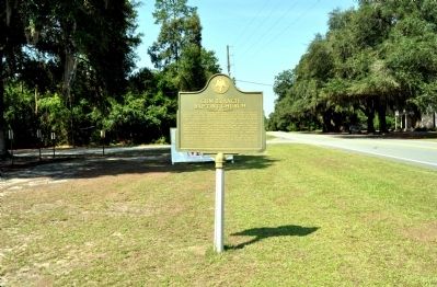
Location. 31° 51.544′ N, 81° 43.487′ W. Marker is near Hinesville, Georgia, in Liberty County. Marker is on Georgia Route 196, 0.1 miles west of John Wells Road, on the left when traveling west. Touch for map. Marker is at or near this postal address: 8590 Georgia Highway 196 W, Hinesville GA 31313, United States of America. Touch for directions.
Other nearby markers. At least 8 other markers are within 8 miles of this marker, measured as the crow flies. Taylors Creek Methodist Church and Cemetery (approx. 6.9 miles away); Bradwell Institute (approx. 7.1 miles away); Charlton Hines House (approx. 7.6 miles away); Old Liberty County Jail (approx. 7.6 miles away); Hinesville Methodist Church (approx. 7.6 miles away); Fort Morris Cannon (approx. 7.6 miles away); Bradwell Park (approx. 7.6 miles away); Liberty County (approx. 7.6 miles away). Touch for a list and map of all markers in Hinesville.
Credits. This page was last revised on June 16, 2016. It was originally submitted on August 7, 2012, by David Seibert of Sandy Springs, Georgia. This page has been viewed 792 times since then and 37 times this year. Photos: 1, 2, 3. submitted on August 7, 2012, by David Seibert of Sandy Springs, Georgia. • Craig Swain was the editor who published this page.


