Marker Logo HMdb.org THE HISTORICAL
MARKER DATABASE
“Bite-Size Bits of Local, National, and Global History”
Amsterdam in Montgomery County, New York — The American Northeast (Mid-Atlantic)
 

Guy Park

Revolutionary War Heritage Trail


Guy Park Marker image. Click for full size.
Photographed By Howard C. Ohlhous, September 1, 2010
1. Guy Park Marker
Inscription.
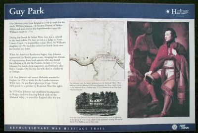
Guy Johnson came from Ireland in 1756 to work for his uncle, William Johnson. He became Deputy of Indian Affairs and took over as the Superintendent upon Sir William's death in 1774.

During the French & Indian Wars, Guy was a colonel in the local militia. He later served as a judge in Tryon County Court. He married his cousin Mary, Sir William's daughter, in 1763 and settled on family lands near her brother and sister.

When the American Revolution began, Guy Johnson represented the British government, bringing him threats of imprisonment from local patriots who also feared his influence with the Six Nations. In July 1775 Guy Johnson, his family, loyal supporters and Mohawk allies fled to Canada. On the way, his wife died in childbirth at Oswego.

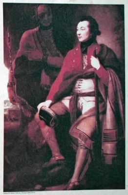
Col Guy Johnson and several Mohawks traveled to England in 1776 to lobby for the Loyalist interests. While there, he and Karonghyontye (Capt. David Hill posed for a portrait by Benjamin West (far right).

By 1779 Guy had established headquarters in Niagara and was directing British raids on the Mohawk Valley. He moved to England after the war.

[Map & Drawing Captions]

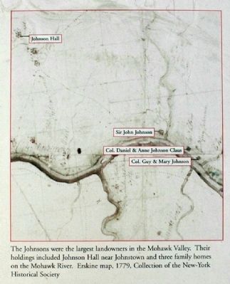
The Johnsons were the largest landowners in the Mohawk Valley. Their holdings included Johnson Hall near Johnstown and three family homes on the Mohawk River. Erskin map, 1779, Collection
Paid Advertisement
Click on the ad for more information.
Please report objectionable advertising to the Editor.
Click or scan to see
this page online
of the New-York Historical Society

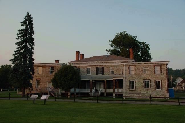
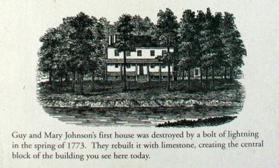
Guy and Mary Johnson's first house was destroyed by a bolt of lightning in the spring of 1773. They rebuilt it with limestone, creating the central block of the building you see here today.
 
Topics. This historical marker is listed in these topic lists: Government & PoliticsNative AmericansPatriots & PatriotismWar, US Revolutionary. A significant historical month for this entry is July 1775.
 
Location. Marker has been reported missing. It was located near 42° 56.815′ N, 74° 12.586′ W. Marker was in Amsterdam, New York, in Montgomery County. Marker could be reached from Evelyn Street just south of New York State Route 5/67. Touch for map. Marker was in this post office area: Amsterdam NY 12010, United States of America. Touch for directions.
 
Other nearby markers. At least 8 other markers are within 2 miles of this location, measured as the crow flies. Center of Operations (within shouting distance of this marker); Guy Park, 1766 (about 300 feet away, measured in a direct line); Pvt. Frank J. Sirchia Memorial (approx. 0.4 miles away); Amsterdam World War Memorial (approx. 0.7 miles away); Claus Mansion (approx. ¾ mile away); Sweet Canal Store (approx. 1.1 miles away); Chuctanunda Terrace Site (approx. 1.1 miles away); Donato (Dan) Persico, Chief T/M (approx. 1.1 miles away). Touch for a list and map of all markers in Amsterdam.
 
Guy Park Marker image. Click for full size.
Photographed By Howard C. Ohlhous, September 1, 2010
2. Guy Park Marker
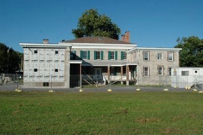
There were two post-mounted interpretive markers on the lawn to the left, the Guy Park marker was the one on the right.
sectionhead>More about this marker. The marker was behind the building, however it is no longer there because it was lost or destroyed during the flooding that followed Hurricane Irene in August of 2011

 
Also see . . .  Guy Park - National Archives. National Register of Historic Places documentation (Submitted on March 24, 2024, by Anton Schwarzmueller of Wilson, New York.) 
 
Guy Park Marker Detail image. Click for full size.
Photographed By Howard C. Ohlhous, September 1, 2010
3. Guy Park Marker Detail
Guy Park Marker Detail image. Click for full size.
Photographed By Howard C. Ohlhous, September 1, 2010
4. Guy Park Marker Detail
Guy Park Marker Detail image. Click for full size.
Photographed By Howard C. Ohlhous, September 1, 2010
5. Guy Park Marker Detail
Guy Park - Hurricane Irene Flooding image. Click for full size.
Photographed By Howard C. Ohlhous, August 29, 2011
6. Guy Park - Hurricane Irene Flooding
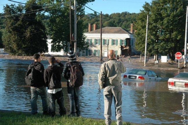
In late August of 2011 the Mohawk River, swollen by the rains of Hurricane Irene, flooded in many places of the lower Mohawk Valley. Here the residents of Amsterdam watch in amazement as the river tears away at Guy Park Manor causing significant damage to the building.
Guy Park Damaged image. Click for full size.
Photographed By Howard C. Ohlhous, September 2, 2011
7. Guy Park Damaged
The view of the south side of Guy Park Manor from across the Mohawk River shows that the west wing, added to the building by owner James Stewart in the 1840s, sags dangerously. In the foreground the uprights which support the movable dam at Lock E11 have been badly damaged by the flooding of August 28-29, 2011 after Hurricane Irene.
Guy Park Manor - One Year after Irene image. Click for full size.
Photographed By Howard C. Ohlhous, August 29, 2012
8. Guy Park Manor - One Year after Irene
A year after the flooding took place the building has been stabilized and awaits rebuilding. The Guy Park Marker was in the back of the building before the flooding washed it away.
 
 
Credits. This page was last revised on March 24, 2024. It was originally submitted on August 31, 2012, by Howard C. Ohlhous of Duanesburg, New York. This page has been viewed 856 times since then and 54 times this year. Photos:   1, 2, 3, 4, 5, 6, 7, 8. submitted on August 31, 2012, by Howard C. Ohlhous of Duanesburg, New York. • Bill Pfingsten was the editor who published this page.

Share this page.  
Share on Tumblr
m=58970

CeraNet Cloud Computing sponsors the Historical Marker Database.
This website earns income from purchases you make after using our links to Amazon.com. We appreciate your support.
Paid Advertisement
May. 5, 2024