Near Vischer Ferry in Saratoga County, New York — The American Northeast (Mid-Atlantic)
Cast Iron Whipple Truss Bridge, 1869
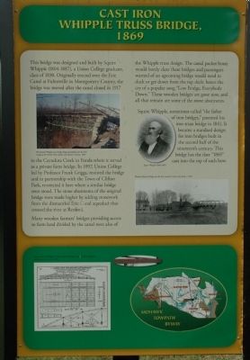
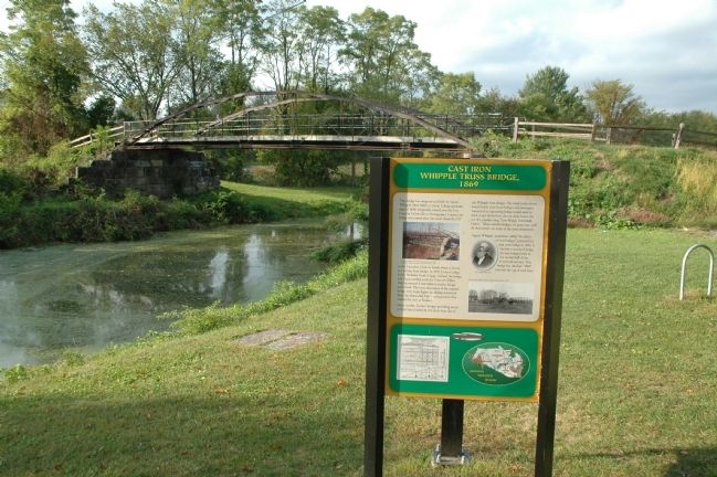
This bridge was designed and built by Squire Whipple (1804-1887), a Union college graduate, class of 1830. Originally erected over the Erie Canal at Fultonville in Montgomery County, the bridge was moved after the canal closed in 1917 to the Cayadutta Creek in Fonda where it served as a private farm bridge. In 1997, Union College led by Professor Frank Griggs, restored the bridge and in partnership with the Town of Clifton Park, re-erected it here where a similar bridge once stood. The stone abutments of the original bridge were made higher by adding stonework from the dismantled Erie Canal aqueduct that crossed the river at Rexford.
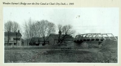
Many wooden farmers' bridges providing access to farm land divided by the canal were also of the Whipple truss design. The canal packet boats would barely clear these bridges and passengers warned of an upcoming bridge would need to duck or get down from the top deck: hence the cry of a popular song "Low Bridge, Everybody Down." These wooden bridges are gone now, and all that remain are some of the stone abutments.
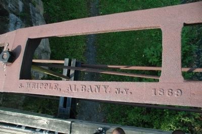
Squire Whipple, sometimes called "the father of iron bridges," patented his iron truss bridge in 1841. It became a standard design for iron bridges built in the second half of the nineteenth century. This bridge has the date "1869" cast into the top of each bow.
Topics and series. This historical marker is listed in these topic lists: Bridges & Viaducts • Waterways & Vessels. In addition, it is included in the Erie Canal series list. A significant historical year for this entry is 1830.
Location. 42° 47.578′ N, 73° 47.741′ W. Marker is near Vischer Ferry, New York, in Saratoga County. Marker is on Riverview Road close to Van Vranken Road, on the right when traveling east. Touch for map. Marker is in this post office area: Rexford NY 12148, United States of America. Touch for directions.
Other nearby markers. At least 8 other markers are within walking distance of this marker. Vischer Ferry Nature and Historic Preserve (here, next to this marker); Whipple Iron Truss Bridge (within shouting distance of this marker); Erie Canal (within shouting distance of this marker); Fort's Ferry (approx. 0.4 miles away); Van Vranken Home, 1847 (approx. 0.7 miles away); Van Vranken Farm (approx. 0.9 miles away); Clutes Dry Dock (approx. one mile away); a different marker also named Clute’s Dry Dock (approx. one mile away). Touch for a list and map of all markers in Vischer Ferry.
Also see . . . Squire Whipple. Wikipedia entry (Submitted on November 29, 2021, by Larry Gertner of New York, New York.)
Additional keywords.
Cayuduta Creek
Credits. This page was last revised on November 29, 2021. It was originally submitted on September 23, 2012, by Howard C. Ohlhous of Duanesburg, New York. This page has been viewed 712 times since then and 19 times this year. Photos: 1, 2, 3, 4, 5. submitted on September 23, 2012, by Howard C. Ohlhous of Duanesburg, New York. • Bill Pfingsten was the editor who published this page.


