West Fallowfield Township near Hartstown in Crawford County, Pennsylvania — The American Northeast (Mid-Atlantic)
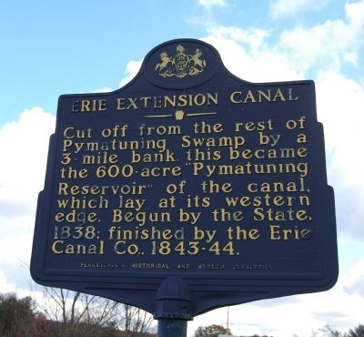
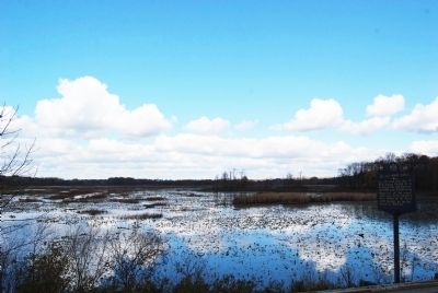
Erie Extension Canal
Erected 1948 by Pennsylvania Historical and Museum Commission.
Topics and series. This historical marker is listed in this topic list: Waterways & Vessels. In addition, it is included in the Erie Canal, and the Pennsylvania Historical and Museum Commission series lists. A significant historical year for this entry is 1838.
Location. 41° 33.219′ N, 80° 22.456′ W. Marker is near Hartstown, Pennsylvania, in Crawford County. It is in West Fallowfield Township. Marker is on Liberty Street (U.S. 322) 0.2 miles east of Center Street, on the right when traveling west. Touch for map. Marker is at or near this postal address: 614 Liberty St, Hartstown PA 16131, United States of America. Touch for directions.
Other nearby markers. At least 8 other markers are within 7 miles of this marker, measured as the crow flies. This Tablet (approx. 5 miles away); To the Memory of the Brave (approx. 5.1 miles away); The Ice Industry and the Ice Houses (approx. 5.1 miles away); a different marker also named Erie Extension Canal (approx. 5.1 miles away); Geology (approx. 5.1 miles away); The Railroads (approx. 5.1 miles away); Jamestown Community Veterans Memorial (approx. 5.9 miles away); Blue Streak (approx. 6.4 miles away).
Credits. This page was last revised on February 7, 2023. It was originally submitted on October 21, 2012, by Mike Wintermantel of Pittsburgh, Pennsylvania. This page has been viewed 561 times since then and 52 times this year. Photos: 1, 2. submitted on October 21, 2012, by Mike Wintermantel of Pittsburgh, Pennsylvania.

