Tornillo in El Paso County, Texas — The American South (West South Central)
Tornillo
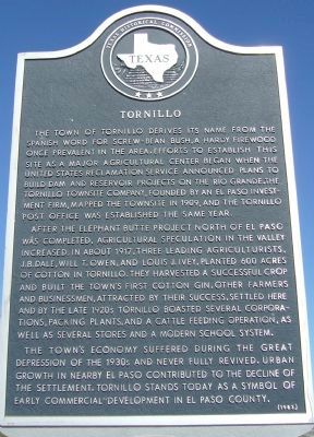
After the Elephant Butte project north of El Paso was completed, agricultural speculation in the area increased. In about 1917, three leading agriculturists, J.B. Dale, Will T. Owen, and Louis J. Ivey, planted 600 acres of cotton in Tornillo. They harvested a successful crop and built the town's first cotton gin. Other farmers and businessmen, attracted by their success, settled here and by the late 1920s, Tornillo boasted several corporations, packing plants, and a cattle feeding operation, as well as several stores and a modern school system.
The town's economy suffered in the Great Depression of the 1930s and never fully revived. Urban growth in nearby El Paso contributed to the decline of the settlement. Tornillo stands today as a symbol of early commercial development in El Paso County.
Erected 1983 by Texas Historical Commission. (Marker Number 5509.)
Topics. This historical marker is listed in these topic lists: Agriculture • Settlements & Settlers. A significant historical year for this entry is 1909.
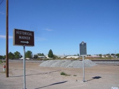
Location. 31° 26.743′ N, 106° 5.332′ W. Marker is in Tornillo, Texas, in El Paso County. Marker is at the intersection of Alameda Avenue (State Highway 20) and 3rd Street, on the right when traveling west on Alameda Avenue. Marker is on the northwest corner. Touch for map. Marker is in this post office area: Tornillo TX 79853, United States of America. Touch for directions.
Other nearby markers. At least 8 other markers are within 15 miles of this marker, measured as the crow flies. San Elizario Chapel (approx. 14˝ miles away); Juan de Onate Expedition - 1598 (approx. 14˝ miles away); San Elizario (approx. 14˝ miles away); San Elizario Memorial Plaza (approx. 14˝ miles away); Espejo Beltran Expedition - 1582-1583 (approx. 14˝ miles away); a different marker also named San Elizario (approx. 14˝ miles away); Rodriguez-Chamuscado Expedition - 1581 (approx. 14˝ miles away); Salt War (approx. 14˝ miles away).
Credits. This page was last revised on June 16, 2016. It was originally submitted on October 30, 2012, by Bill Kirchner of Tucson, Arizona. This page has been viewed 861 times since then and 104 times this year. Photos: 1, 2. submitted on October 30, 2012, by Bill Kirchner of Tucson, Arizona. • Bernard Fisher was the editor who published this page.

