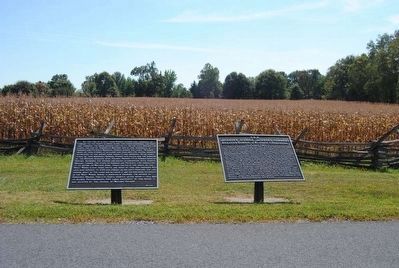
Near Sharpsburg in Washington County, Maryland — The American Northeast (Mid-Atlantic)
Jackson's Division, Jackson's Command
Jackson's Division, Jackson's Command.
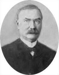
Brigadier General J.R. Jones, Commanding.
(September 17, 1862.)
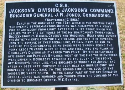
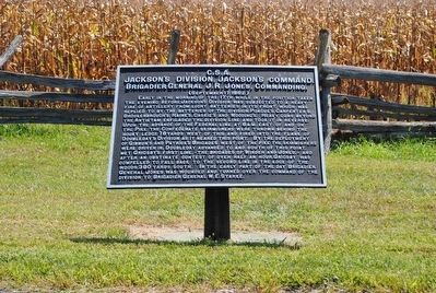
Early in the morning of the 17,th while in the position taken the evening before, Jackson's Division was subjected to a heavy fire of artillery from light batteries in its front, which was replied to by the batteries of the division, Poague's, Carpenter's, Brockenbrough's, Raine's, Caskie's and Wooding's. Heavy guns beyond the Antietam enfiladed the division line and took it in reverse. Upon the advance of the Federal line, at 6 a.m., east of and on the Pike the Confederate skirmishers were thrown behind the rocky ledge 78 yards west of this and fired into the flank of Doubleday's Division as it neared this point. By the deployment of Gibbon's and Patrick's Brigades west of the pike the skirmishers were driven in; Doubleday advanced to and south of this point, met Grigsby's first line, - the brigades of Winder and Jones, - and after an obstinate contest of over half an hour, Grigsby was compelled to fall back to the second line in the edge of the woods, 380 yards south. In the early part of the day Brigadier General Jones was wounded and turned command of the division to Brigadier General W.E. Starke.
(Second, continuation, tablet):
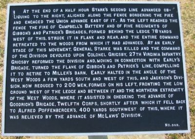
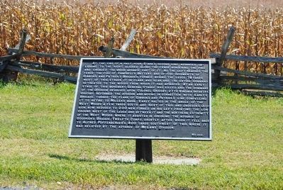
At the end of a half hour Starke's second line advanced obliquing to the right, aligned along the fence bordering the pike and engaged the Union advance east of it. As the left reached the fence the fire of Campbell's Battery and of five regiments of Gibbon's and Patrick's Brigades, formed behind the ledge 78 yards west of this, struck it in flank and rear, and the entire command retreated to the woods from which it had advanced. At an early stage of this movement, General Starke was killed and the command of the Division devolved upon Colonel Grigsby, 27th Virginia Infantry. Grigsby reformed the division and, moving in connection with Early's Brigade, turned the flank of Gobbon's and Patrick's line, compelling it to retire to Miller's Barn. Early halted in the angle of the West Woods a few yards south and west of this, and Jackson's Division, now reduced to 200 men, formed on his left, fronting the low ground west of the ledge and between it and the northern extremity of the West Woods, where it assisted in checking the advance of Goodrich's Brigade, Twelfth Corps, shortly after which it fell back to Alfred Poffenberger's, 400 yards southwest of this, where it was relieved by the advance of McLaw's Division.
Erected by Antietam Battlefield Board. (Marker Number 382.)
Topics and series. This historical marker is listed in this topic list: War, US Civil. In addition, it is included in the Antietam Campaign War Department Markers series list. A significant historical year for this entry is 1862.
Location. 39° 28.84′ N, 77° 44.956′ W. Marker is near Sharpsburg, Maryland, in Washington County. Marker is on Starke Avenue, on the right when traveling east. Touch for map. Marker is in this post office area: Sharpsburg MD 21782, United States of America. Touch for directions.
Other nearby markers. At least 8 other markers are within walking distance of this marker. A different marker also named Jackson's Division, Jackson's Command (a few steps from this marker); First Army Corps (within shouting distance of this marker); 124th Pennsylvania Volunteer Infantry (within shouting distance of this marker); Aftermath Along the Hagerstown Turnpike (about 300 feet away, measured in a direct line); New Jersey State Monument (about 300 feet away); 13th New Jersey Infantry (about 300 feet away); Doubleday's Division, First Army Corps (about 300 feet away); Twelfth Army Corps (about 300 feet away). Touch for a list and map of all markers in Sharpsburg.
Also see . . .
1. Antietam Battlefield. National Park Service site. (Submitted on March 12, 2008, by Craig Swain of Leesburg, Virginia.)
2. Jackson's Division. General John R. Jones fell into disgrace after the Battle of Antietam. Officially reported as "stunned" by an artillery shell during the battle, Jones was later accused of cowardice. Shortly after the battle of Fredericksburg, he was removed from command. (Submitted on March 12, 2008, by Craig Swain of Leesburg, Virginia.)
Photographed By Craig Swain
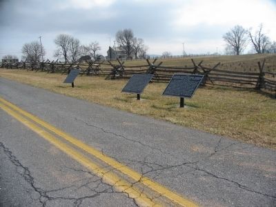
5. Confederate Tablets on Starke Avenue
These tablets detail the actions of Jackson's Division. Number 381 (furthest from the camera) discusses the unit's operations on the day before the battle. The two closest to the camera are collectively number 382, detailing the division's operations during the Battle of Antietam.
Photographed By Craig Swain, April 6, 2008
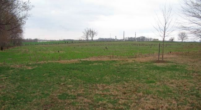
8. Jackson's Division Fights near the West Woods
Looking from near the Philadelphia Monument to the North at the intersection of Cornfield Avenue and Dunker Church Road (old Hagerstown Pike). Jackson's old division fought much of the early phases of the battle in and around this open field. The division's strength had been greatly reduced during the spring Shenandoah Campaign, Seven Day's Fighting, Cedar Mountain, Second Manassas, and the Siege of Harpers Ferry. By the time of the battle of Antietam, the Division had around 1,600 effective soldiers.
Credits. This page was last revised on October 25, 2017. It was originally submitted on March 12, 2008, by Craig Swain of Leesburg, Virginia. This page has been viewed 887 times since then and 16 times this year. Photos: 1, 2. submitted on March 12, 2008, by Craig Swain of Leesburg, Virginia. 3, 4. submitted on October 19, 2015, by Brian Scott of Anderson, South Carolina. 5. submitted on March 12, 2008, by Craig Swain of Leesburg, Virginia. 6, 7. submitted on October 19, 2015, by Brian Scott of Anderson, South Carolina. 8. submitted on August 3, 2008, by Craig Swain of Leesburg, Virginia.
