Near Sharpsburg in Washington County, Maryland — The American Northeast (Mid-Atlantic)
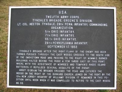
Twelfth Army Corps
Tyndale's Brigade, Greene's Division
Twelfth Army Corps
Tyndale's Brigade, Greene's Division
Lt. Col. Hector Tyndale, 28th Penn. Infantry, Commanding.
Organization.
5th Ohio Infantry,
7th Ohio Infantry,
66th Ohio Infantry,
28th Pennsylvania Infantry.
September 17, 1862.
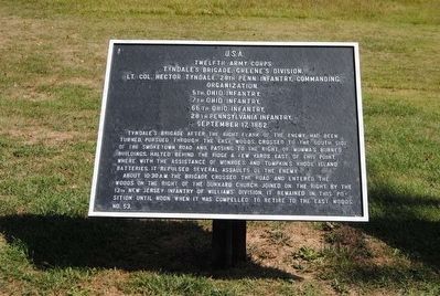
Tyndale's Brigade after the right flank of the enemy had been turned, pursued through the East Woods, crossed to the south side of the Smoketown Road and, passing to the right of Mumma's burned buildings, halted behind the ridge a few yards east of this point, where, with the assistance of Monroe's and Tompkin's Rhode Island Batteries, it repulsed several assaults of the enemy.
About 10:30 a.m. the Brigade crossed the road and entered the woods on the right of the Dunkard Church, joined on the right by the 13th New Jersey Infantry of Williams's Division, it remained in this position until noon when it was compelled to retired to the East Woods.
Erected by Antietam Battlefield Board. (Marker Number 53.)
Topics and series. This historical marker is listed in this topic list: War, US Civil. In addition, it is included in the Antietam Campaign War Department Markers series list. A significant historical date for this entry is September 17, 1862.
Location. 39° 28.526′ N, 77° 44.782′ W. Marker is near Sharpsburg, Maryland, in Washington County. Marker is at the intersection of Dunker Church Road / Old Hagerstown Pike and Smoketown Road, on the right when traveling north on Dunker Church Road / Old Hagerstown Pike. Located at stop one of the driving tour of Antietam Battlefield, across the road from the Dunker Church in a tablet cluster. Touch for map. Marker is in this post office area: Sharpsburg MD 21782, United States of America. Touch for directions.
Other nearby markers. At least 8 other markers are within walking distance of this marker. Second Army Corps (here, next to this marker); a different marker also named Twelfth Army Corps (here, next to this marker); Greene's Division, Twelfth Army Corps (here, next to this marker); Reserve Artillery, Longstreet's Command (here, next to this marker); 5th, 7th and 66th Ohio Infantry Monument (a few steps from this marker); Dunkard Church (within shouting distance of this marker); Destroy the Rebel Army (within shouting distance of this marker); a different marker also named "Destroy the Rebel Army" (within shouting distance of this marker). Touch for a list and map of all markers in Sharpsburg.
Related markers. Click here for a list of markers that are related to this marker. Follow Tyndale's Brigade by Tablets.
Also see . . .
1. Antietam Battlefield. National Park Service site. (Submitted on March 16, 2008, by Craig Swain of Leesburg, Virginia.)
2. 1st Brigade, 2nd Division, XII Corps. By the time the Brigade left the East Woods, Major Orrin Crane had replaced the wounded Tyndale in command. Crane would write in his official report, "So terrific was the fire of our men that the enemy fell like grass before the mower; so deadly was the fire that the enemy retreated in great disorder, they not being able to rally their retreating forces." (Submitted on March 16, 2008, by Craig Swain of Leesburg, Virginia.)
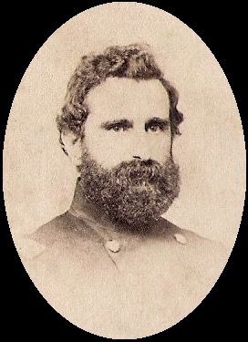
3. Hector Tyndale. Hector Tyndale was a Union general during the American Civil War rising to the rank of Brevet Major General of Volunteers. He notably led brigades at the battles of Antietam and Wauhatchie. (Submitted on October 15, 2015, by Brian Scott of Anderson, South Carolina.)
Photographed By Craig Swain, February 9, 2008
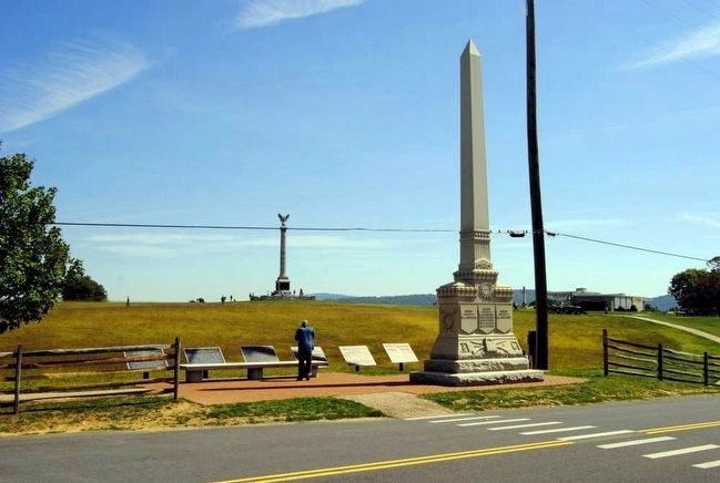
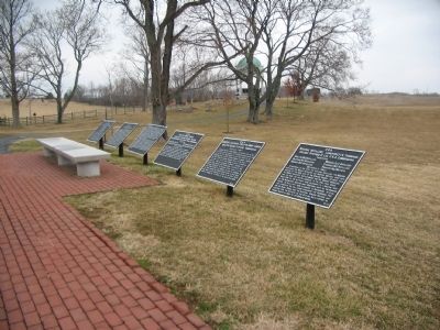
4. Tablet Cluster Opposite the Dunker Church
Five numbered tablets, with one continuation tablet, stand in front of the Dunker Church on the east side of the old Pike. These are, from furthest from the camera, Tyndale's Brigade (53), Second Army Corps (116), continuation tablet for 116, Goodrich's Brigade (114), Greene's Division (51), and Reserve Artillery of Longstreet's Command (306).
Photographed By Craig Swain, February 9, 2008
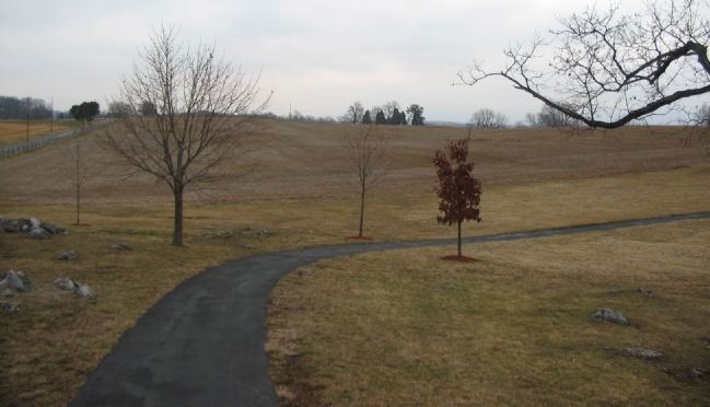
6. Tyndale's Brigade Holds the Line
From the Maryland State monument looking east down the Smoketown Road (on the left side of photo). As Sedgwick's Division was driven out of the West Woods, Tyndale's Brigade was a cornerstone of a Federal defensive line which prevented the entire sector from collapsing. Supported by artillery, the Brigade held along what amounted to a reverse slope defense between what is today the Maryland and New York State monuments. The Brigade's right flank was placed in the foreground here.
Photographed By Craig Swain, March 29, 2008
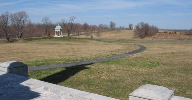
7. Brigade Position
Looking from the New York State Monument, to the north, with the Maryland State Monument on the left. This view demonstrates the profile of the ground where the brigade defended. The 28th Pennsylvania was in the foreground, with the Ohio regiments extending to the north out to the Smoketown Road.
Credits. This page was last revised on December 7, 2017. It was originally submitted on March 16, 2008, by Craig Swain of Leesburg, Virginia. This page has been viewed 800 times since then and 20 times this year. Photos: 1. submitted on March 16, 2008, by Craig Swain of Leesburg, Virginia. 2, 3. submitted on October 15, 2015, by Brian Scott of Anderson, South Carolina. 4. submitted on March 16, 2008, by Craig Swain of Leesburg, Virginia. 5. submitted on October 15, 2015, by Brian Scott of Anderson, South Carolina. 6. submitted on March 16, 2008, by Craig Swain of Leesburg, Virginia. 7. submitted on April 4, 2008, by Craig Swain of Leesburg, Virginia.
