Shingletown in Shasta County, California — The American West (Pacific Coastal)
People of the Land
Photographed By Don Morfe, July 3, 2009
1. People of the Land Marker
Photo caption:
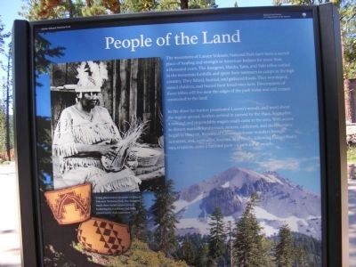
Using plant materials native to Lassen Volcanic National Park, the Atsugewi made these hand-woven baskets, honoring the traditions and skills passed down by their ancestors. The marker is near the entrance to the Loomis Museum
Using plant materials native to Lassen Volcanic National Park, the Atsugewi made these hand-woven baskets, honoring the traditions and skills passed down by their ancestors. The marker is near the entrance to the Loomis Museum
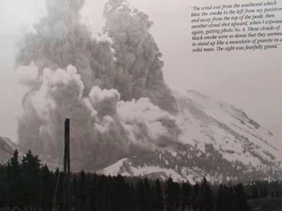
In the 1820s fur traders penetrated Lassen’s woods, and word about the region spread. Settlers arrived in earnest by the 1850s. Soon after, a railroad and dependable wagon roads came to the area. With access to distant markets lumberman, miners, cattlemen, and sheepherders began to flourish. Reports of Lassen’s volcanic wonders brought scientists, and, soon after, tourists. And finally, following Lassen Peak’s 1915 eruption, came a national park - a park for all people.
Erected by National Park Service.
Topics. This historical marker is listed in this topic list: Environment. A significant historical year for this entry is 1915.
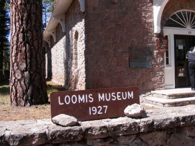
Location. 40° 32.724′ N, 121° 34.578′ W. Marker is in Shingletown, California, in Shasta County. Marker is on Lassen Peak Highway (SR 89). The marker is located near the Lassen Volcanic National Park Visitor Center which is the Loomis Museum. Touch for map. Marker is in this post office area: Shingletown CA 96088, United States of America. Touch for directions.
Other nearby markers. At least 8 other markers are within 4 miles of this marker, measured as the crow flies. Historic Crossroads Gateway (about 400 feet away, measured in a direct line); Stephen Tyng Mather (approx. 0.9 miles away); Loomis Legacy (approx. 0.9 miles away); Nobles Trail – Third Nobles Pass (approx. 1.2 miles away); Nobles Trail - Manzanita Creek (approx. 1.2 miles away); Nobles' Emigrant Trail (approx. 2˝ miles away); Mt. Lassen/The Noble Pass/The Park Highway (approx. 2˝ miles away); Nobles Trail - Table Mountain (approx. 3.6 miles away). Touch for a list and map of all markers in Shingletown.
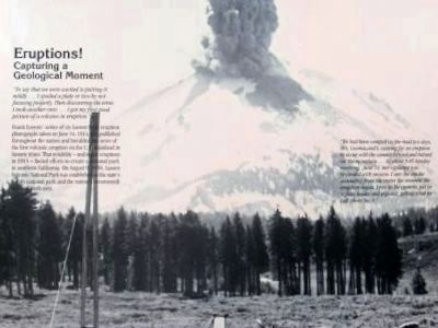
Photographed By Frank Loomis (Re-photo), June 14, 1914
7. Photo on Display at the Loomis Museum
Capturing a Geological Moment
Click on photo to see additional photo captions.
Credits. This page was last revised on June 16, 2016. It was originally submitted on February 14, 2013, by Don Morfe of Baltimore, Maryland. This page has been viewed 530 times since then and 19 times this year. Photos: 1, 2, 3, 4, 5. submitted on February 14, 2013, by Don Morfe of Baltimore, Maryland. 6, 7, 8. submitted on February 15, 2013, by Don Morfe of Baltimore, Maryland. • Syd Whittle was the editor who published this page.
Editor’s want-list for this marker. Photo showing a full view of the marker. • Wide area view of the marker and its surroundings. • Can you help?
