Franklintown in Baltimore, Maryland — The American Northeast (Mid-Atlantic)
Crimea Estate
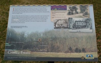
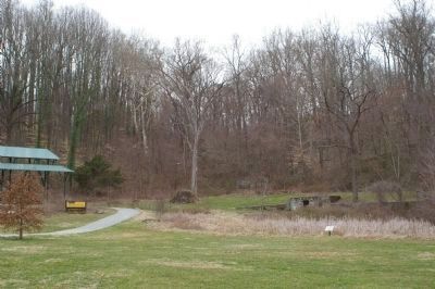
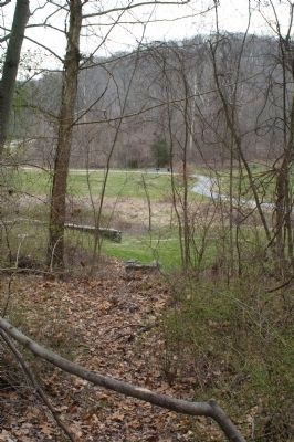
In the mid-1800s this meadow and hillside were part of Thomas Winans' country estate, the Crimea. After returning from Russia, where he helped build the St. Petersburg-Moscow railroad, Winans established this estate. He and his Russian-born wife, Celeste, also had an in-town mansion, Aledoffsky, which no longer exists.
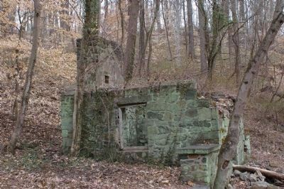
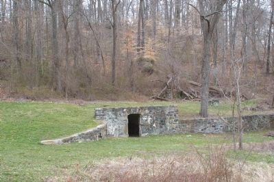
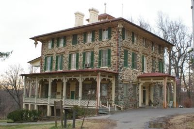
You can follow the old stone roadway or a pathway that leads to the Victorian stone mansion, called Orianda, and small wooden chapel at the top of the hill. At the pathway's midpoint is a mock battlement, which may have been built to protect the Confederate-sympathizing Winatis family or to represent a Crimean War fortification. Near the stream, to the left, you will see a large iron wheel that pumped water to the mansion.
[Captions:]
Leakin Park encompasses the Crimea estate, which the City of Baltimore purchased in 1941 and 1948 with a bequest left by John Wilson Leakin.
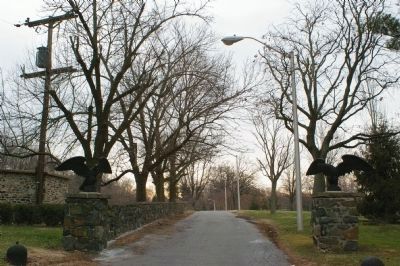
The cast-iron eagles still flank the Windsor Mill Road entrance to Crimea as they did in this 1926 photo.
Orianda, the Crimea mansion, was built in 1856-57.
A large water wheel pumped water to the Crimea estate.
Erected by Gwynns Falls Trail Council.
Topics and series. This historical marker is listed in these topic lists: Architecture • Railroads & Streetcars • Settlements & Settlers • War, US Civil. In addition, it is included in the Maryland, Gwynns Falls Trail series list. A significant historical year for this entry is 1941.
Location. 39° 18.243′ N, 76° 41.731′ W. Marker is in Baltimore, Maryland. It is in Franklintown. Marker can be reached from North Franklintown Road. Marker is on trail, 500 feet east of parking lot. Touch for map. Marker is at or near this postal address: 4700 N Franklintown Rd, Baltimore MD 21229, United States of America. Touch for directions.
Other nearby markers. At least 8 other markers are within walking distance of this marker. A Name Before a Place (about 300 feet away, measured in a direct line); Leakin Park at Winans Meadow (about 400 feet away); Crimea Mansion (approx. 0.2 miles away); Orianda House (approx. 0.2 miles away); Crimea (approx. 0.2 miles away); Norman Van Allan Reeves (approx. ¼ mile away); Chapel (approx. 0.3 miles away); Caretaker House (approx. 0.4 miles away). Touch for a list and map of all markers in Baltimore.
Also see . . .
1. Image of the marker. (Submitted on March 17, 2008, by Christopher Busta-Peck of Shaker Heights, Ohio.)
2. Gwynns Falls Trail Council. (Submitted on March 17, 2008, by Christopher Busta-Peck of Shaker Heights, Ohio.)
Credits. This page was last revised on February 17, 2021. It was originally submitted on March 17, 2008, by Christopher Busta-Peck of Shaker Heights, Ohio. This page has been viewed 4,044 times since then and 59 times this year. Photos: 1, 2, 3, 4, 5, 6, 7. submitted on March 19, 2008, by Christopher Busta-Peck of Shaker Heights, Ohio.
