Wakefield in Baltimore, Maryland — The American Northeast (Mid-Atlantic)
Dickeyville's Historic Legacy
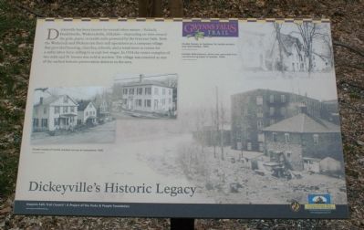
Dickeyville has been known by several other names - Tschudi, Franklinville, Wetheredville, Hillsdale - depending on who owned the grist, paper, or textile mills powered by the Gwynns Falls. Both the Wethereds and Dickeys ran their mill operations as a company village that provided housing, churches, schools, and a retail store in return for a stable labor force willing to accept low wages. In 1934 the entire complex of two mills and 81 houses was sold at auction. The village was restored as one of the earliest historic preservation districts in the area.
[Captions:]
Former homes of textile workers on the eve of restoration, 1936.
Double houses, or duplexes, for textile workers and their families, 1920s.
Franklin Mills (below, which was converted from manufacturing paper to textiles, 1920s.
Erected by Gwynns Falls Trail Council.
Topics and series. This historical marker is listed in these topic lists: Industry & Commerce • Settlements & Settlers • Waterways & Vessels. In addition, it is included in the Maryland, Gwynns Falls Trail series list. A significant historical year for this entry is 1934.
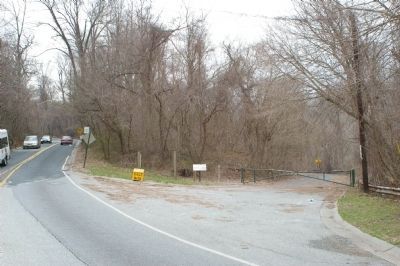
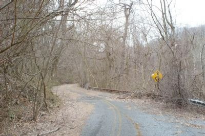
Location. 39° 18.756′ N, 76° 41.41′ W. Marker is in Baltimore, Maryland. It is in Wakefield. Marker is at the intersection of Windsor Mill Road and Weatheredsville Road, on the right when traveling west on Windsor Mill Road. Marker is at the northwest corner of the intersection. Note that Wetheredsville Road is no longer open to motorized vehicle traffic. Touch for map. Marker is at or near this postal address: 4513 Windsor Mill Rd, Gwynn Oak MD 21207, United States of America. Touch for directions.
Other nearby markers. At least 8 other markers are within walking distance of this marker. An Old Mill Stream (about 500 feet away, measured in a direct line); Seeing the Forest for the Trees (about 500 feet away); Gwynns Falls Park at Windsor Mill Road (about 600 feet away); Leakin Park at Winans Meadow (approx. 0.6 miles away); A Name Before a Place (approx. 0.6 miles away); Leakin Park at the Crimea Estate (approx. 0.6 miles away); Norman Van Allan Reeves (approx. 0.6 miles away); Chapel (approx. 0.7 miles away). Touch for a list and map of all markers in Baltimore.
Also see . . .
1. Image of the marker. (Submitted on March 17, 2008, by Christopher Busta-Peck of Shaker Heights, Ohio.)
2. Gwynns Falls Trail Council. (Submitted on March 17, 2008, by Christopher Busta-Peck of Shaker Heights, Ohio.)
Credits. This page was last revised on February 17, 2021. It was originally submitted on March 17, 2008, by Christopher Busta-Peck of Shaker Heights, Ohio. This page has been viewed 3,095 times since then and 15 times this year. Photos: 1, 2, 3. submitted on March 19, 2008, by Christopher Busta-Peck of Shaker Heights, Ohio.


