Fisherman's Wharf in San Francisco City and County, California — The American West (Pacific Coastal)
Petaluma's Sternwheel
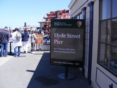
Hyde Street Pier
— San Francisco Maritime National Historic Park —
“After 35 years, 8 months and 10 days we tie up for good. This ends 103 years of stern wheel navigation of S.F. Bay and tributaries. John H. Urton, Master”
Final Log Entry, dated August 24, 1950.
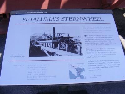
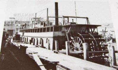
The Petaluma was the last of the San Francisco riverboats. During the nineteenth century, these passenger and cargo boats, operating on the inland river systems, were the primary link between San Francisco and the towns and farming communities of the California interior.
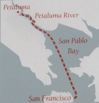
Running between San Francisco and Petaluma, the sternwheeler Petaluma made more than 10,000 trips over the 36-mile route. She carried passengers and served the chicken ranches for which Petaluma was famous.
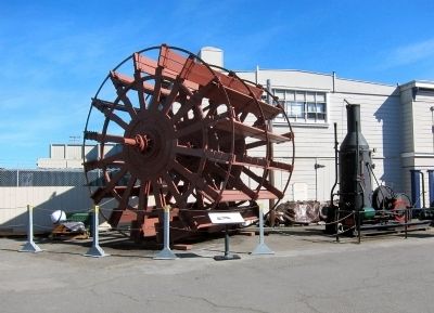
Petaluma’s shallow hull and sternwheel remained useful on the Petaluma River long after her sisters had quit the major rivers. Finally retired in 1950, she was exhibited in Oakland until she burned and sank in 1956. (Inscription next to the map) The San Francisco-to-Petaluma run.
Basic Facts:
Built: 1914, Benicia, California
Builder: James Robertson
Length Overall — 148 feet
Beam — 32 feet, 4 inches
Draft — 7 feet, 6 inches
Engine Type — Horizontal compound
Sternwheel Dia. — 18 feet.
Erected by National Park Service.
Topics. This historical marker is listed in this topic list: Waterways & Vessels. A significant historical year for this entry is 1950.
Location. Marker has been permanently removed. It was located near 37° 48.558′ N, 122° 25.284′ W. Marker was in San Francisco, California, in San Francisco City and County. It was in Fisherman's Wharf. Marker could be reached from Hyde Street north of Jefferson Street. The marker is located on the Hyde Street Pier. Touch for map. Marker was in this post office area: San Francisco CA 94109, United States of America.
We have been informed that this sign or monument is no longer there and will not be replaced. This page is an archival view of what was.
Other nearby markers. At least 8 other markers are within walking distance of this location. Schooner C.A. Thayer (a few steps from this marker); Hyde Street Pier Was Part of Highway 101 (a few steps from this marker); Highway 101 (within shouting distance of this marker); Paddle Tug Eppleton Hall (within shouting distance of this marker); Ship Balclutha (within shouting distance of this marker); The Cathead... (about 300 feet away, measured in a direct line); Why Here? (about 300 feet away); The Forecastle... (about 300 feet away). Touch for a list and map of all markers in San Francisco.
Related marker. Click here for another marker that is related to this marker. Replacement marker: Petaluma’s Sternwheel
Additional commentary.
1. Marker replaced
This marker has been replaced with an updated marker.
— Submitted October 8, 2023, by Joseph Alvarado of Livermore, California.
Credits. This page was last revised on October 8, 2023. It was originally submitted on February 17, 2013, by Don Morfe of Baltimore, Maryland. This page has been viewed 601 times since then and 36 times this year. Photos: 1. submitted on February 17, 2013, by Don Morfe of Baltimore, Maryland. 2, 3, 4, 5. submitted on February 24, 2013. 6, 7. submitted on February 17, 2013, by Don Morfe of Baltimore, Maryland. • Syd Whittle was the editor who published this page.
