Joint Base Anacostia-Bolling (JBAB) in Southeast Washington in Washington, District of Columbia — The American Northeast (Mid-Atlantic)
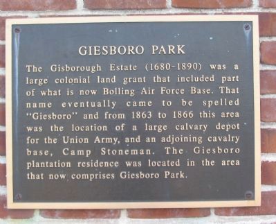
Giesboro Park
Topics. This historical marker is listed in these topic lists: Settlements & Settlers • War, US Civil.
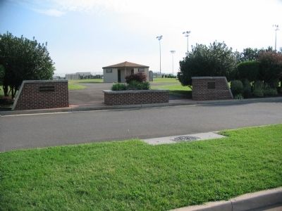
Location. 38° 51.634′ N, 77° 0.184′ W. Marker is in Southeast Washington in Washington, District of Columbia. It is in Joint Base Anacostia-Bolling (JBAB). Marker can be reached from Firth Sterling Avenue Southeast east of South Capitol Street Southeast, on the left when traveling east. Located at the entrance to the athletic fields in Giesboro Park. Touch for map. Marker is in this post office area: Washington DC 20032, United States of America. Touch for directions.
Other nearby markers. At least 8 other markers are within walking distance of this marker. T-28 Trojan (about 700 feet away, measured in a direct line); St. Elizabeths Hospital Civil War Cemetery (approx. 0.4 miles away); Hillsdale (approx. 0.4 miles away); Barry Farm Dwellings (approx. 0.4 miles away); Grandpapa's Farm (approx. 0.4 miles away); Campbell African Methodist Episcopal Church (approx. 0.4 miles away); Roads That Divide (approx. half a mile away); The Curative Powers of Nature (approx. half a mile away). Touch for a list and map of all markers in Southeast Washington.
Regarding Giesboro Park. Current description indicates: "This wartime photo looks from the high ground near where today South Capital Street and Interstate 278 pass." There is no such intersection in that area. Possibly, the writer meant near where South Capital Street and Interstate 295 are today.
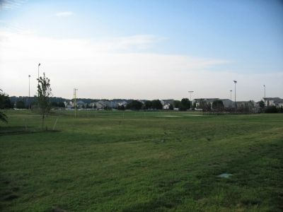
Photographed By Craig Swain, August 7, 2008
3. Giesboro Today
No vestiges of Camp Stoneman or the depot exist today. The ridge line paralleling the Potomac River at this point (in the distance beyond the houses) was heavily fortified during the Civil War. The cavalry camp occupied the low ground between the ridge and the river. Since the 1860s land has been reclaimed from the river, new road structures in place, and new buildings erected.
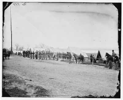
Library of Congress Collection
4. Band at Camp Stoneman
A view of the camp streets when the cavalry camp was in use. Today the United States Air Force Band uses several buildings on the Air Base.
[Libray of Congress: Civil War photographs, 1861-1865 / compiled by Hirst D. Milhollen and Donald H. Mugridge, Washington, D.C. : Library of Congress, 1977. No. 0782, Call number LC-B817- 7350]
[Libray of Congress: Civil War photographs, 1861-1865 / compiled by Hirst D. Milhollen and Donald H. Mugridge, Washington, D.C. : Library of Congress, 1977. No. 0782, Call number LC-B817- 7350]
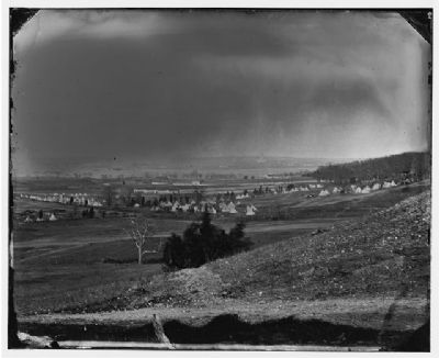
Library of Congress Collection
5. Cavalry Depot
This wartime photo looks from the high ground near where today South Capital Street and Interstate 278 pass. Several distinctive "Sibley" tents are arranged on the low ground. In the distant right center is a rather prominent building, that may be the U.S. Capital dome. If so, then the camera was angled almost due north, looking across the Anacostia River. The photo is dated May 1864.
[Library of Congress Prints and Photographs Division Washington, D.C. 20540 USA, Call Number LC-B817- 7015[P&P]]
[Library of Congress Prints and Photographs Division Washington, D.C. 20540 USA, Call Number LC-B817- 7015[P&P]]
Credits. This page was last revised on January 30, 2023. It was originally submitted on August 7, 2008, by Craig Swain of Leesburg, Virginia. This page has been viewed 5,806 times since then and 127 times this year. Last updated on November 4, 2018, by Nancy Deane of New Bern, North Carolina. Photos: 1, 2, 3, 4, 5. submitted on August 7, 2008, by Craig Swain of Leesburg, Virginia. • Andrew Ruppenstein was the editor who published this page.
