Near Sharpsburg in Washington County, Maryland — The American Northeast (Mid-Atlantic)
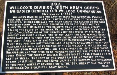
Willcox's Division, Ninth Army Corps
Willcox's Division, Ninth Army Corps.
Brigadier General O.B. Willcox, Commanding.
(September 17, 1862.)
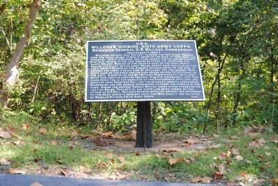
Willcox's Division was the last to cross the Antietam. Passing over the stone bridge at 2 p.m., it moved up the road to this point and deployed. Christ's Brigade was filed across the hollow on the right (east) and formed on the low ground between the creek and the bluff, Welsh's Brigade on the heights west of the road, Christ scaled the bluff on the right, Welsh swept over the hills on the left. Crook's Brigade of the Kanawaha Division moved by the road in support, and under a heavy fire of artillery the line reached Sherrick's Lane on the right and the high ground beyond Otto's House on the left. A section of the 8th Battery, Massachusetts Artillery, went into position in Otto's Orchard. A severe engagement now took place, resulting in the expulsion of the Confederate artillery and infantry from Cemetery Hill and the adjacent heights overlooking Sharpsburg, and the division skirmishers entered the streets of the town. During the contest Crook's Brigade moved up and formed on the left of Welsh. The left of the corps line being turned by the attack of A.P. Hill, Willcox's Division, with its support, was withdrawn to this point where it remained until the 18th, when it was relieved by Morell's Division, Fifth Army Corps.
Erected by Antietam Battlefield Board. (Marker Number 99.)
Topics and series. This historical marker is listed in this topic list: War, US Civil. In addition, it is included in the Antietam Campaign War Department Markers series list. A significant historical year for this entry is 1862.
Location. 39° 27.196′ N, 77° 44.042′ W. Marker is near Sharpsburg, Maryland, in Washington County. Marker is on Old Burnside Bridge Road, on the right when traveling north. Located just north of stop 9 (Burnside Bridge) of the driving tour of Antietam Battlefield. Touch for map. Marker is in this post office area: Sharpsburg MD 21782, United States of America. Touch for directions.
Other nearby markers. At least 8 other markers are within walking distance of this marker. Mission of Death (approx. 0.2 miles away); 21st Massachusetts Volunteer Infantry (approx. 0.2 miles away); "Why Burnside's Bridge?" (approx. 0.2 miles away); Bridge of Destiny (approx. 0.2 miles away); 35th Massachusetts Volunteer Infantry (approx. 0.2 miles away); "Will You Give Us Our Whiskey?" (approx. 0.2 miles away); We Showered the Lead Across that Creek (approx. 0.2 miles away); 2nd Maryland Infantry (approx. ¼ mile away). Touch for a list and map of all markers in Sharpsburg.
Related markers. Click here for a list of markers that are related to this marker. Wilcox's (1st) Division, IX Corps markers.
Also see . . .
1. Antietam Battlefield. National Park Service site. (Submitted on March 20, 2008, by Craig Swain of Leesburg, Virginia.)
2. 1st Division, IX Corps. Orlando B. Willcox commanded this division right up to the end of the war. In his report on the battle of Antietam, he wrote, There is no officer or man among them who cannot feel proud of having been engaged in the battle of Sharpsburg, and I recommend that all the regiments of my division be allowed to inscribe "Sharpsburg" on their colors as well as "South Mountain." (Submitted on March 20, 2008, by Craig Swain of Leesburg, Virginia.)
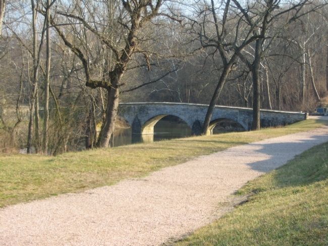
Photographed By Craig Swain, February 9, 2008
5. Old Burnside Bridge Road
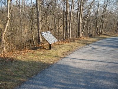
Looking down a foot path which follows the trace of the road down to the Lower Bridge, now commonly called the Burnside Bridge. Willcox's Division cross the bridge over the Antietam starting at 2 p.m. in the afternoon and marched up this road in the direction of Sharpsburg. Another tablet for the division indicates the later position overlooking the Sherrick Farm.
Credits. This page was last revised on December 7, 2017. It was originally submitted on March 20, 2008, by Craig Swain of Leesburg, Virginia. This page has been viewed 970 times since then and 36 times this year. Photos: 1. submitted on March 20, 2008, by Craig Swain of Leesburg, Virginia. 2. submitted on September 30, 2015, by Brian Scott of Anderson, South Carolina. 3. submitted on March 20, 2008, by Craig Swain of Leesburg, Virginia. 4. submitted on September 30, 2015, by Brian Scott of Anderson, South Carolina. 5. submitted on March 20, 2008, by Craig Swain of Leesburg, Virginia.
