Near Sharpsburg in Washington County, Maryland — The American Northeast (Mid-Atlantic)
Ninth Army Corps
Nagle's Brigade, Sturgis' Division
Ninth Army Corps,
Nagle's Brigade, Sturgis' Division,
Brigadier-General James Nagle, Commanding.
Organization
2nd Maryland, 6th and 9th New Hampshire, and
48th Pennsylvania Infantry.
(September 17, 1862.)
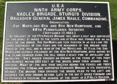
At daylight of the 17th, Nagle's Brigade was about a half mile northeast of this point. It moved to the south and, at 10 a.m. was formed for an assault on the bridge. The 2nd Maryland tood position in an old lane 110 yards southeast of this point, and the remainder of the brigade under cover of the hill and in rear of the 2nd Maryland. At 11 a.m., the 2nd Maryland, closely followed by the 6th New Hampshire, both moving by the flank, charged down the hill under a heavy fire of artillery and musketry. They passed through an opening in the fence at this point and reached within 250 feet of the bridge, when their advance was checked. Many of the men took shelter behind the fences and trees bordering the stream, and supported Ferrero's Brigade in its successful assault. The brigade then crossed the bridge, filed to the left and occupied the high ground beyond. Late in the day it moved forward and co-operated in checking the advance of the right of A.P. Hill's Division.
Erected by Antietam Battlefield Board. (Marker Number 69.)
Topics and series. This historical marker is listed in this topic list: War, US Civil. In addition, it is included in the Antietam Campaign War Department Markers series list. A significant historical year for this entry is 1862.
Location. 39° 26.995′ N, 77° 43.8′ W. Marker is near Sharpsburg, Maryland, in Washington County. Marker can be reached from Old Burnside Bridge Road, on the right when traveling east. Located to the east of stop 9 (Burnside Bridge) of the driving tour of Antietam Battlefield. Touch for map. Marker is in this post office area: Sharpsburg MD 21782, United States of America. Touch for directions.
Other nearby markers. At least 8 other markers are within walking distance of this marker. Eleventh Connecticut Infantry (within shouting distance of this marker); U.S. Geological Survey Streamflow-Gaging Station (within shouting distance of this marker); 11th Connecticut Volunteer Infantry (within shouting distance of this marker); As the Georgians Saw It (about 300 feet away, measured in a direct line); a different marker also named Ninth Army Corps (about 400 feet away); Sturgis's Division, Ninth Army Corps (about 400 feet away); Fifty-First New York Infantry (about 400 feet away); a different marker also named Ninth Army Corps (about 400 feet away). Touch for a list and map of all markers in Sharpsburg.
Also see . . .
1. Antietam Battlefield. National Park Service site. (Submitted on March 20, 2008, by Craig Swain of Leesburg, Virginia.)
2. 1st Brigade, 2nd Division, IX Corps. (Submitted on March 20, 2008, by Craig Swain of Leesburg, Virginia.)

Photographed By Craig Swain, September 17, 2007
3. Nagle's Brigade Tablet
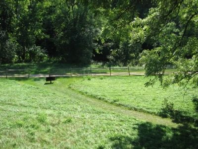
The tablet stands beside the Old Burnside Bridge Road. Vehicle traffic is no longer allowed on this segment of the road, or the bridge. The 2nd Maryland was aligned along the creek in the low ground here. The two New Hampshire regiments were to its right, closer to the camera.
Credits. This page was last revised on November 24, 2017. It was originally submitted on March 20, 2008, by Craig Swain of Leesburg, Virginia. This page has been viewed 785 times since then and 18 times this year. Photos: 1. submitted on March 20, 2008, by Craig Swain of Leesburg, Virginia. 2. submitted on April 1, 2008, by Craig Swain of Leesburg, Virginia. 3. submitted on March 20, 2008, by Craig Swain of Leesburg, Virginia.

