Near Sabinal in Uvalde County, Texas — The American South (West South Central)
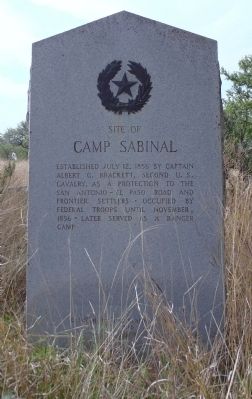
Site of Camp Sabinal
Erected 1936 by State of Texas. (Marker Number 4746.)
Topics and series. This historical marker is listed in these topic lists: Forts and Castles • Roads & Vehicles. In addition, it is included in the San Antonio-El Paso Road, and the Texas 1936 Centennial Markers and Monuments series lists. A significant historical date for this entry is July 12, 1853.
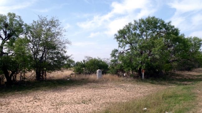
Location. 29° 18.824′ N, 99° 28.942′ W. Marker is near Sabinal, Texas, in Uvalde County. Marker is on U.S. 90, 0.4 miles east of Lower Sabinal Road (County Road 310), on the right when traveling east. This marker is about 50 yards from the highway. There is no pull-off. To visit the marker turn into the entrance to a ranch gate just before the Sabinal River bridge. The marker will be on your right. Touch for map. Marker is in this post office area: Sabinal TX 78881, United States of America. Touch for directions.
Other nearby markers. At least 8 other markers are within 11 miles of this marker, measured as the crow flies. Sabinal Methodist Church (approx. 0.9 miles away); The Sabinal Wait Station (approx. one mile away); First Baptist Church of Sabinal (approx. one mile away); Sabinal (approx. 1.4 miles away); John M. Davenport (approx. 1.4 miles away); Emmanuel Lutheran Church (approx. 9.4 miles away); Town of Knippa (approx. 9˝ miles away); Knippa Trap Rock Plant (approx. 10.3 miles away). Touch for a list and map of all markers in Sabinal.
More about this marker. One of the large granite "Star and Wreath" type monument markers placed over 75 years ago by the State of Texas during the state's centennial year of 1936.
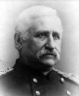
Regarding Site of Camp Sabinal. Albert Gallatin Brackett, soldier, was born in Cherry Valley, Otsego County, New York, 14 February, 1829. He removed to Indiana in 1846, and, during the war with Mexico, was First Lieutenant in the 4th Indiana Volunteer Infantry, attached to Lane's Brigade. Brackett was honorably mustered out, 16 July 1848.
On 3 March, 1855, he became captain in the 2nd United States Cavalry, and, after raising a company in Indiana and Illinois, served on the Texas frontier, including service at Fort Clark in 1856, distinguishing himself in actions against the Comanche Indians. He was the first United States officer that crossed into Mexico in pursuit of hostile Indians.
To his additional credit Brackett was a published author and well respected in the profession of arms for his knowledge of the cavalry and cavalry operations. He authored "General Lane's Brigade in Central Mexico" (Cincinnati, 1854) and "History of the United States Cavalry" (New York, 1865). He also wrote many magazine and newspaper articles, especially in regard to military affairs and the development of the country.
He retired in 1891, when he was Colonel of the Third Cavalry. Colonel A. G. Brackett, died at his residence in Washington on June 25, 1896 and is interred in Arlington National Cemetery.
Credits. This page was last revised on October 17, 2016. It was originally submitted on April 16, 2013, by William F Haenn of Fort Clark (Brackettville), Texas. This page has been viewed 1,246 times since then and 61 times this year. Photos: 1, 2, 3. submitted on April 16, 2013, by William F Haenn of Fort Clark (Brackettville), Texas. • Bernard Fisher was the editor who published this page.


