Turner's Creek Landing in Kent County, Maryland — The American Northeast (Mid-Atlantic)
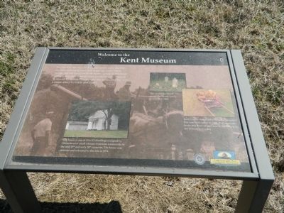
Welcome to the Kent Museum
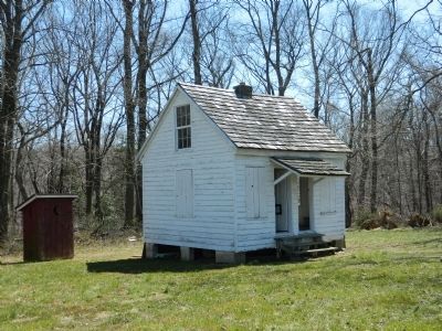
This house is one of 10 to 12 dwellings occupied by Chestertown's small African-American community in the mid-19th and early 20th centuries. The house was restored and relocated to this site in 1974.
Kent County farmer John Schauber invented this corn stalk cutter in 1907. It allowed one horse and three or four men to harvest up to ten acres of corn a day.
This on-site graveyard served the Stavely family from 1628 to 1840.
Erected by Chesapeake Bay Gateways Network.
Topics. This historical marker is listed in these topic lists: African Americans • Cemeteries & Burial Sites • Industry & Commerce • Notable Places. A significant historical year for this entry is 1974.
Location. 39° 21.149′ N, 75° 59.187′ W. Marker is in Turner's Creek Landing, Maryland, in Kent County. Marker is on Turners Creek Road, on the right when traveling north. Touch for map. Marker is in this post office area: Kennedyville MD 21645, United States of America. Touch for directions.
Other nearby markers. At least 8 other markers are within walking distance of this marker. Corn Crib (about 600 feet away, measured in a direct line); Charley's House (about 600 feet away); The Tockwogh and the Bay (approx. 0.2 miles away); Captain John Smith on the Sassafras River (approx. 0.2 miles away); A Home with a Rich Past (approx. 0.2 miles away); Natural Diversity at Turner's Creek (approx. 0.2 miles away); Agricultural Demonstration Area / Historic Tree Grove (approx. ¼ mile away); Turner's Creek (approx. 0.4 miles away). Touch for a list and map of all markers in Turner's Creek Landing.
Credits. This page was last revised on June 16, 2016. It was originally submitted on April 18, 2013, by Bill Pfingsten of Bel Air, Maryland. This page has been viewed 494 times since then and 16 times this year. Photos: 1, 2. submitted on April 18, 2013, by Bill Pfingsten of Bel Air, Maryland.

