Santa Fe in Santa Fe County, New Mexico — The American Mountains (Southwest)
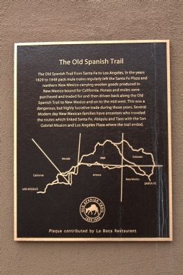
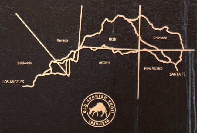
The Old Spanish Trail
Erected by Old Spanish Trail Association and La Boca Restaurant.
Topics and series. This historical marker is listed in these topic lists: Animals • Industry & Commerce • Roads & Vehicles. In addition, it is included in the Old Spanish National Trail series list. A significant historical year for this entry is 1829.
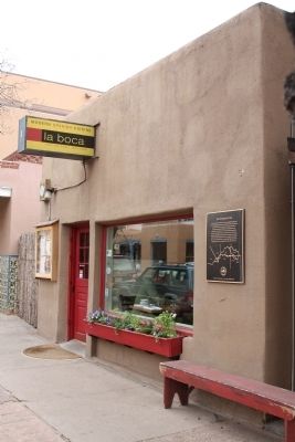
Location. 35° 41.357′ N, 105° 56.273′ W. Marker is in Santa Fe, New Mexico, in Santa Fe County. Marker is on West Marcy Street near Lincoln Avenue, on the right when traveling east. Touch for map. Marker is at or near this postal address: 72 West Marcy Street, Santa Fe NM 87501, United States of America. Touch for directions.
Other nearby markers. At least 8 other markers are within walking distance of this marker. Staff Sergeant Leroy A. Petry (within shouting distance of this marker); Hewett House (about 400 feet away, measured in a direct line); Officer's Quarters (about 400 feet away); Fray Angélico Chávez (about 400 feet away); The Courtyard of Catua and Omtua (about 400 feet away); Hitching Post at the End of the Trail (about 500 feet away); Cut Stone Facade with Quoin (about 600 feet away); Site of Santa Fe’s First Chapel (about 600 feet away). Touch for a list and map of all markers in Santa Fe.
Also see . . . Old Spanish Trail Association. “For traveling Mexican caravans between 1829 and 1848, the Old Spanish National Historic Trail was known as the shortest path to riches between Los Angeles and Santa Fe. It was a trail of commercial opportunity and western adventure as well as slave trading, horse thieving and raids. The Old Spanish Trail route was established along a loose network of Indian footpaths that crossed the wide expanse of the Colorado Plateau and the Mojave Desert. With time, this newly established trade corridor attracted frontiersmen and U.S. military expeditions. For a lucky few, the Old Spanish Trail represented fortune. Quality woolen goods produced in New Mexico were traded for a surplus supply of horses and mules raised on California’s ranchos. These valued stock animals commanded premium prices in New Mexico and the western frontier of the United States. Traders and their mule caravans typically began their annual journey from New Mexico in late fall to take advantage of low water river crossings and cooler temperatures across the hot Mojave desert.” (Submitted on April 28, 2013.)
Credits. This page was last revised on January 6, 2020. It was originally submitted on April 28, 2013, by J. J. Prats of Powell, Ohio. This page has been viewed 550 times since then and 14 times this year. Photos: 1, 2, 3. submitted on April 28, 2013, by J. J. Prats of Powell, Ohio.


