Scott State Park in Scott County, Kansas — The American Midwest (Upper Plains)
El Cuartelejo
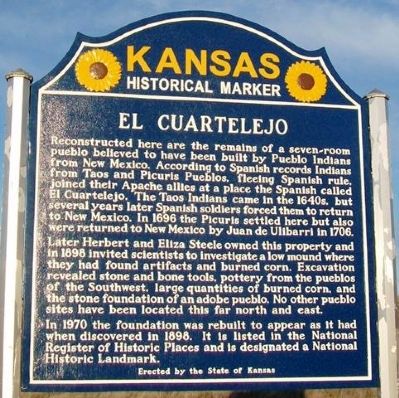
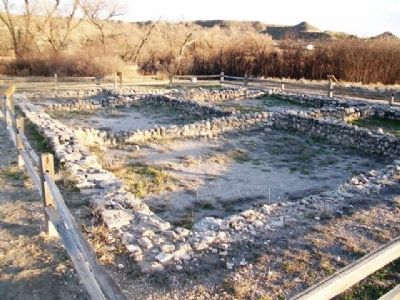
Reconstructed here are the remains of a seven-room pueblo believed to have been built by Pueblo Indians from New Mexico. According to Spanish records Indians from Taos and Picuris Pueblos, fleeing Spanish rule, joined their Apache allies at a place the Spanish called El Cuartelejo. The Taos Indians came in the 1640s, but several years later Spanish soldiers forced them to return to New Mexico. In 1696 the Picuris settled here but also were returned to New Mexico by Juan de Ulibarri in 1706.
Later Herbert and Eliza Steele owned this property and in 1898 invited scientists to investigate a low mound where they had found artifacts and burned corn. Excavation revealed stone and bone tools, pottery from the pueblos of the Southwest, large quantities of burned corn, and the stone foundation of an adobe pueblo. No other pueblo sites have been located this far north and east.
In 1970 the foundation was rebuilt to appear as it had when discovered in 1898. It is listed in the National Register of Historic Places and is designated a National Historic Landmark.
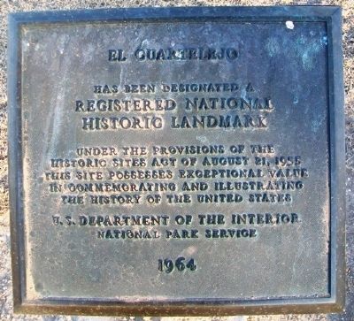
El Cuartelejo
has been designated a
Registered National
Historic Landmark
Under the provisions of the
Historic Sites Act of August 21, 1935
this site possesses exceptional value
in commemorating and illustrating
the history of the United States
U.S. Department of the Interior
National Park Service
1964
Erected 2012 by the State of Kansas. (Marker Number 81(B).)
Topics and series. This historical marker is listed in these topic lists: Exploration • Landmarks • Native Americans. In addition, it is included in the Kansas Historical Society, and the National Historic Landmarks series lists. A significant historical year for this entry is 1696.
Location. 38° 40.615′ N, 100° 54.901′ W. Marker is in Scott State Park, Kansas, in Scott County. Marker is on West Scott Lake Drive, on the right when traveling north. Touch for map. Marker is in this post office area: Scott City KS 67871, United States of America. Touch for directions.
Other nearby markers. At least 8 other markers are within 12 miles of this marker, measured as the crow flies. Pueblo Floor Plan (a few steps from this marker); Plains Apache at El Cuartelejo (a few steps from this marker); El Cuartelejo Archeology (a few steps from this marker); El Quartelejo (within shouting distance of this marker); Steele Memorial (approx. ¼ mile away); Battle Canyon, 1878 (approx. 2.4 miles away); a different marker also named El Quartelejo (approx. 3.3 miles away); BOD (approx. 11.3 miles away). Touch for a list and map of all markers in Scott State Park.
More about this marker. This marker replaced an earlier Kansas Historical Marker.
Also see . . .
1. El Cuartelejo. Kansapedia entry (Submitted on June 13, 2013, by William Fischer, Jr. of Scranton, Pennsylvania.)
2. History of Scott State Park, Kansas. Kansas Department of Wildlife, Parks and Tourism website entry (Submitted on June 13, 2013, by William Fischer, Jr. of Scranton, Pennsylvania.)
3. Western Vistas Historic Byway. Kansas Byways website entry (Submitted on April 24, 2021, by Larry Gertner of New York, New York.)
4. Migration of the Pueblo People to El Cuartelejo (Middle School Teaching Aid). Kansas Historical Society website entry (Submitted on June 13, 2013, by William Fischer, Jr. of Scranton, Pennsylvania.)
Credits. This page was last revised on April 24, 2021. It was originally submitted on June 13, 2013, by William Fischer, Jr. of Scranton, Pennsylvania. This page has been viewed 808 times since then and 39 times this year. Photos: 1, 2, 3, 4. submitted on June 13, 2013, by William Fischer, Jr. of Scranton, Pennsylvania.


