Verdi in Washoe County, Nevada — The American Mountains (Southwest)
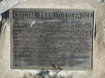
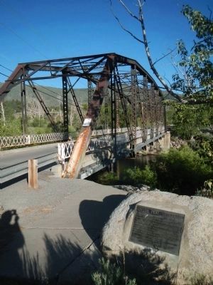
Crystal Peak Toll Bridge
Erected 1985 by E Clampus Vitus, Chief Truckee Chapter No. 3691.
Topics and series. This historical marker is listed in these topic lists: Bridges & Viaducts • Roads & Vehicles. In addition, it is included in the E Clampus Vitus series list. A significant historical year for this entry is 1860.
Location. 39° 31.453′ N, 119° 59.629′ W. Marker is in Verdi, Nevada, in Washoe County. Marker is on Bridge Street west of Lakeview Drive, on the right when traveling north. Touch for map. Marker is at or near this postal address: 449 Bridge Street, Verdi NV 89439, United States of America. Touch for directions.
Other nearby markers. At least 8 other markers are within walking distance of this marker. Verdi Veterans Memorial (approx. ¼ mile away); Henness Pass Road O'Neill Station (approx. 0.4 miles away); Von Schmidt (approx. 0.4 miles away); Henness Pass Road (approx. 0.4 miles away); Truckee/Donner Trail (approx. 0.4 miles away); Overview (approx. 0.4 miles away); The Town of Crystal Peak (approx. 0.4 miles away); Inyo Marble Works (approx. half a mile away). Touch for a list and map of all markers in Verdi.
More about this marker. This marker is located where Bridge Street crosses the Truckee River.
Credits. This page was last revised on June 16, 2016. It was originally submitted on June 16, 2013, by Barry Swackhamer of Brentwood, California. This page has been viewed 599 times since then and 36 times this year. Photos: 1, 2. submitted on June 16, 2013, by Barry Swackhamer of Brentwood, California. • Syd Whittle was the editor who published this page.

