Near Beckwourth in Plumas County, California — The American West (Pacific Coastal)
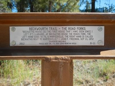
Beckwourth Trail – The Road Forks
“Beckwiths House (is) the first house that I have seen since I left (Ft.) Laramie... at Beckwiths House the roads fork, the left hand goes to 76 & Maryesville, the right hand is called Beckwiths rout to Maryesville.” – John F. Freeman, Sep 13, 1852
Erected 2012 by Trails West Inc. (Marker Number B - 11.)
Topics and series. This historical marker is listed in this topic list: Roads & Vehicles. In addition, it is included in the Beckwourth Trail, the California Trail, and the Trails West Inc. series lists. A significant historical date for this entry is September 13, 1852.
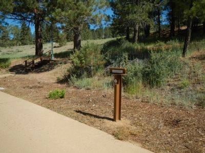
Location. 39° 49.425′ N, 120° 24.837′ W. Marker is near Beckwourth, California, in Plumas County. Marker can be reached from Feather River Highway (Route 70), on the left when traveling west. This marker is located at the Lester T. Davis Safety Roadside Rest Area, west of Beckwourth. Touch for map. Marker is at or near this postal address: 78646 Feather River Highway, Beckwourth CA 96129, United States of America. Touch for directions.
Other nearby markers. At least 8 other markers are within 4 miles of this marker, measured as the crow flies. Sierra Valley History (within shouting distance of this marker); Step Back In Time (within shouting distance of this marker); James P. Beckwourth Ranch and Trading Post (within shouting distance of this marker); Jim Beckwourth Trading Post (approx. 0.4 miles away); James P. Beckwourth (approx. 0.4 miles away); Hope Lodge No. 234 F & AM (approx. 1.9 miles away); Beckwourth Trail - Head Waters of Feather River (approx. 2 miles away); Plumas County Honor Roll World War Two and Korea and Vietnam (approx. 3.4 miles away). Touch for a list and map of all markers in Beckwourth.
Also see . . . Trails West Inc. Photo Tour. Follow the historic Beckwourth Trail with a photo tour of 50 official T markers documenting notable segments along the trail. (Submitted on February 9, 2018, by Douglass Halvorsen of Klamath Falls, Oregon.)
Credits. This page was last revised on February 11, 2018. It was originally submitted on June 21, 2013, by Barry Swackhamer of Brentwood, California. This page has been viewed 552 times since then and 27 times this year. Photos: 1, 2. submitted on June 21, 2013, by Barry Swackhamer of Brentwood, California. • Syd Whittle was the editor who published this page.

