New Manchester in Hancock County, West Virginia — The American South (Appalachia)
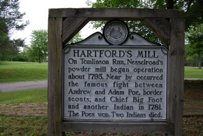
Hartford's Mill
Topics and series. This historical marker is listed in these topic lists: Industry & Commerce • Native Americans. In addition, it is included in the West Virginia Archives and History series list. A significant historical year for this entry is 1795.
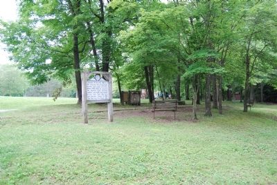
Location. 40° 32.469′ N, 80° 34.484′ W. Marker is in New Manchester, West Virginia, in Hancock County. Marker is at the intersection of Park-Forest 801 and Park-Forest 802, on the right when traveling north on Park-Forest 801. Located in Tomlinson Run State Park, on the road to the campground. Touch for map. Marker is in this post office area: New Manchester WV 26056, United States of America. Touch for directions.
Other nearby markers. At least 8 other markers are within 4 miles of this marker, measured as the crow flies. On This Spot (approx. 2.9 miles away); Early Mills (approx. 2.9 miles away); Village of Stratton Veterans Memorial Park (approx. 3.1 miles away in Ohio); Old Town (approx. 3.3 miles away); World Wars I & II Memorial (approx. 3.4 miles away in Ohio); Empire (approx. 3.4 miles away in Ohio); Ohio River (approx. 3˝ miles away); New Cumberland (approx. 3˝ miles away).

Photographed By Mike Wintermantel, July 7, 2013
3. Hartford's Grist Mill Marker
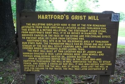
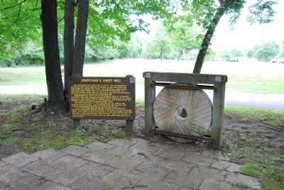
The millstone displayed here is one of the few remaining artifacts from four gristmills located along Tomlinson Run. This stone is a nether millstone, the stationary lower stone, from Hartford's Grist Mill. It is 44 inches in diameter. The grooves carved in the face of the stone are for cooling effect, to prevent meal or flour from catching fire.
Hartford's Mill site is in the wilderness area of Tomlinson Run State Park. The foundation walls can be found one mile downstream of the old mill scout camping area, 200 yards below the covered bridge abutments along Laurel Trail.
The first mill built at this location was by Joseph and Hannah Coulter in 1834. Later owners were John Newell and Thomas Webb, George Baxter, Sr., George Baxter, Jr.
John B. Hartford rented the mill in the years 1880-1882. Hartford purchased the mill in 1882, converted the mill to steam power, and added a circular saw mill. It was 1894 before Hartford received a deed for the mill and 37 acres. John lost the mill in 1905 for failure to pay taxes. The mill was later destroyed by a flash flood.
Credits. This page was last revised on June 16, 2016. It was originally submitted on July 7, 2013, by Mike Wintermantel of Pittsburgh, Pennsylvania. This page has been viewed 915 times since then and 69 times this year. Photos: 1, 2, 3, 4. submitted on July 7, 2013, by Mike Wintermantel of Pittsburgh, Pennsylvania.


