Near Lovelock in Churchill County, Nevada — The American Mountains (Southwest)
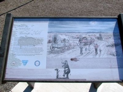
Traveling Through Hell
Regardless of its horrors, it became the accepted route. The trail splits three miles southeast of here into the two main trails to California--the Carson River and Truckee River routes. Each route had its advantages and disadvantages, but both of them included a 40-mile-long stretch before water could be reached.
Starvation for men and animals stalked every mile. A survey made in 1850 showed these appalling statistics: 1061 dead mules, almost 5,000 horses, 3,750 cattle, and 953 graves. The then value of personal property loss was set at $1 million. When emigrants had crossed the Forty-Mile Desert and lived to tell about it ... they had truly "seen the Elephant." And as one diarist described, "We saw the Elephant and ate its tail!"
The heaviest traffic came from 1849 to 1859. The route was still being used by some travelers after completion of the Central Pacific Railroad in 1869.
(Bottom Bar)
"Seeing the Elephant"
The expression "Seeing the Elephant" was commonly used by emigrants who made the journey to California between 1841 and 1869. No one really knows where the expression began, but it may have originated from seeing the elephants that European circuses first brought to American about this time. The large, strange beasts were a huge hit, and people who saw one could not find words to describe the animal.
On the trail, the term came to be associated with the difficulties of the journey. It was almost a badge of honor to say that you had "seen the elephant," had experienced difficulties that others would not understand or believe, and had made it through. This part of the California Trail was one of the places where the elephant was often "seen."
(Drawing Captions)
"Here, indeed, was a picture of misery, which, if I had witnessed before being hardened to scenes of the like character, would have made my heart's blood run cold, and even now the chill of horror ran over me like electricity. Dead horses and oxen, in great numbers, with steaks cut out of their flesh, lay scattered over the land, and men, without a morsel to eat, were begging from wagon to wagon, offering all they had for a little dry bread. The more dishonest, however, were practicing the crafty scheme of theft."
John T. Clapp; July 15, 1850
(illegible) glimpse of the posterior
parts of the elephant. (illegible) he came rapidly in sight and we got view of him tail and trunk.
Samuel C. Plummer, 1850
"All hands early up anxious to see the path that leads to the elephant."
John Clark, 1852
Erected by Bureau of Land Management.
Topics and series. This historical marker is listed in these topic lists: Roads & Vehicles • Settlements & Settlers. In addition, it is included in the California Trail series list. A significant historical date for this entry is July 15, 1822.
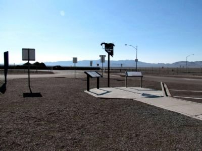
Location. 39° 56.437′ N, 118° 44.974′ W. Marker is near Lovelock, Nevada, in Churchill County. Marker can be reached from the intersection of U.S. 95 and Interstate 80, on the right when traveling south. Marker is located at the Trinity Rest Area on US 95 and is accessed from Exit 83 of Interstate 80. Touch for map. Marker is in this post office area: Lovelock NV 89419, United States of America. Touch for directions.
Other nearby markers. At least 4 other markers are within walking distance of this marker. About Your Journey ... (here, next to this marker); A Home of Early Man (here, next to this marker); Forty Mile Desert (within shouting distance of this marker); Truckee Trail - Forty Mile Desert (approx. ¾ mile away).
More about this marker. The marker is in poor condition, and parts of the marker are difficult to read or illegible.
Credits. This page was last revised on October 14, 2020. It was originally submitted on August 6, 2013, by Duane Hall of Abilene, Texas. This page has been viewed 668 times since then and 26 times this year. Photos: 1, 2. submitted on August 6, 2013, by Duane Hall of Abilene, Texas.

