West Ashley in Charleston in Charleston County, South Carolina — The American South (South Atlantic)
A Unique Find Brings Unanswered Questions
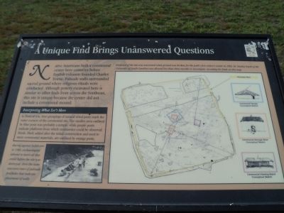
Native Americans built a ceremonial center here centuries before English colonists founded Charles Towne. Palisade walls surrounded sacred ground where religious rituals were conducted. Although pottery excavated here is similar to other finds from across the Southeast, this site is unique because the center did not include a ceremonial mound.
Interpreting What Isn’t Here
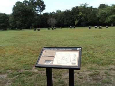
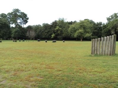
In front of you, four groupings of natural wood posts mark the outer corners of the ceremonial site. The smaller area outlined by blue posts was probably a temple, while purple posts indicate platforms from which ceremonies could be observed. Sheds, likely added after the initial construction and used to store ceremonial materials, are outlined by orange posts.
Topics. This historical marker is listed in this topic list: Native Americans.
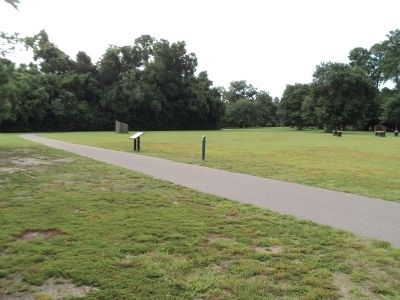
Location. 32° 48.382′ N, 79° 59.093′ W. Marker is in Charleston, South Carolina, in Charleston County. It is in West Ashley. Marker can be reached from Old Town Plantation Road. Marker is located on the History Trail at Charles Towne Landing. Touch for map. Marker is at or near this postal address: 1500 Old Towne Road, Charleston SC 29407, United States of America. Touch for directions.
Other nearby markers. At least 8 other markers are within walking distance of this marker. “Brave & Happy Settlements” (about 400 feet away, measured in a direct line); In Need of an Ally (about 500 feet away); Cassique of the Kiawah (about 500 feet away); Foundations of the Southern Plantation (about 600 feet away); Tales of the Tub (about 700 feet away); Charles Towne / Old Town Plantation (about 700 feet away); a different marker also named Foundations of the Southern Plantation (about 700 feet away); Site of Old Charles Town (about 700 feet away). Touch for a list and map of all markers in Charleston.
More about this marker. A map on the right side of the marker shows the area and indicates the location of archeological finds and the Palisade Walls. It also includes conceptual sketches of a Ceremonial Temple, Ceremonial Storage Shed, and Ceremonial Viewing Stand. It has a caption of “Evidence of the site was uncovered when ground was broken for the park’s first visitor’s center in 1969. Dr. Stanley South of the University of South Carolina was allowed less than three months to investigate, recording his finds on this map.”
A photo of archaeologists working at this site appears at the lower left of the marker, and contains the caption “Racing against bulldozers in 1969, archaeologists labored to learn all they could before the site was destroyed. Here the team uncovers rows of palisade postholes that indicate placement of walls.”
Credits. This page was last revised on February 16, 2023. It was originally submitted on August 19, 2013, by Bill Coughlin of Woodland Park, New Jersey. This page has been viewed 603 times since then and 18 times this year. Photos: 1, 2, 3, 4. submitted on August 19, 2013, by Bill Coughlin of Woodland Park, New Jersey.


