Near Sinclair in Carbon County, Wyoming — The American West (Mountains)
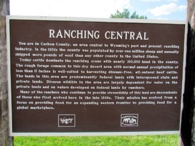
Ranching Central
Today cattle dominate the ranching scene with nearly 100,000 head in the county. The rough forage common to this dry desert area with normal annual precipitation of less than 11 inches is well-suited to harvesting disease-free, all-natural beef cattle. The lands in this area are predominately federal lands with interspersed state and private lands. Diverse wildlife in the area are largely dependent for water on the private lands and on waters developed on federal lands by ranchers.
Many of the ranchers who continue to provide stewardship of this land are descendents of those who first arrived here in the late 1800s. Their mission has evolved from a focus on providing food for an expanding western frontier to providing food for a global marketplace.
Topics. This historical marker is listed in this topic list: Agriculture.
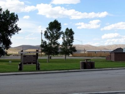
Location. 41° 45.223′ N, 106° 57.061′ W. Marker is near Sinclair, Wyoming, in Carbon County. Marker can be reached from Old Highway, 0.1 miles east of County Road 347, on the left when traveling east. Marker is located at the I-80 rest area at Exit 228 which is accessible to both eastbound and westbound traffic. Touch for map. Marker is in this post office area: Sinclair WY 82334, United States of America. Touch for directions.
Other nearby markers. At least 8 other markers are within 2 miles of this marker, measured as the crow flies. Fort Fred Steele (within shouting distance of this marker); Wyoming - A Fortress for Wildlife (about 300 feet away, measured in a direct line); Cemetery (approx. 1.4 miles away); Powder Magazine (approx. 1.4 miles away); Fenimore Chatterton (approx. 1.4 miles away); A Tourist's Railroad (approx. 1.4 miles away); Early Construction (approx. 1˝ miles away); Fort Fred Steele State Historic Site (approx. 1˝ miles away). Touch for a list and map of all markers in Sinclair.
Credits. This page was last revised on June 16, 2016. It was originally submitted on August 22, 2013, by Duane Hall of Abilene, Texas. This page has been viewed 475 times since then and 9 times this year. Photos: 1, 2. submitted on August 22, 2013, by Duane Hall of Abilene, Texas.

