Plymouth in Luzerne County, Pennsylvania — The American Northeast (Mid-Atlantic)
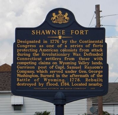
Shawnee Fort
Erected 2003 by Pennsylvania Historical and Museum Commission.
Topics and series. This historical marker is listed in these topic lists: Colonial Era • Settlements & Settlers • War, US Revolutionary. In addition, it is included in the Pennsylvania Historical and Museum Commission series list. A significant historical year for this entry is 1776.
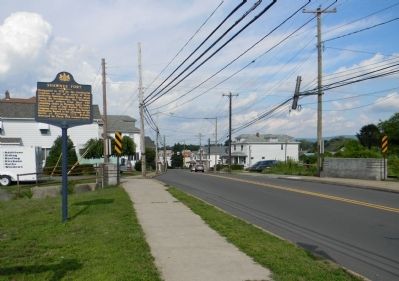
Location. 41° 14.119′ N, 75° 57.678′ W. Marker is in Plymouth, Pennsylvania, in Luzerne County. Marker is on West Main Street (U.S. 11) 0.1 miles south of Coal Street, on the right when traveling south. Touch for map. Marker is at or near this postal address: 747 West Main Street, Plymouth PA 18651, United States of America. Touch for directions.
Other nearby markers. At least 8 other markers are within walking distance of this marker. Abijah Smith & Company (a few steps from this marker); Sephaniah Reese (approx. 0.7 miles away); World War I Memorial (approx. 0.7 miles away); 28th Infantry Division Memorial (approx. 0.7 miles away); Vietnam War Memorial (approx. 0.7 miles away); Sergeant Sherwood Baker (approx. 0.7 miles away); War Memorial (approx. 0.9 miles away); Gulf War Memorial (approx. 0.9 miles away). Touch for a list and map of all markers in Plymouth.
Related marker. Click here for another marker that is related to this marker. To better understand the relationship, study the marker shown.
Also see . . .
1. A Plymouth Pioneer Bastion Stockade that existed during the Revolutionary War is long gone. One of the sturdy frontier forts that protected early settlers of the Wyoming Valley largely faded from memory after a flooded Susquehanna River washed it away in 1784. (Submitted on September 22, 2013, by PaulwC3 of Northern, Virginia.)
2. Report of the Commission to Locate the Site of the Frontier Forts of Pennsylvania. (Submitted on September 22, 2013, by PaulwC3 of Northern, Virginia.)
Credits. This page was last revised on June 16, 2016. It was originally submitted on September 22, 2013, by PaulwC3 of Northern, Virginia. This page has been viewed 799 times since then and 38 times this year. Photos: 1, 2. submitted on September 22, 2013, by PaulwC3 of Northern, Virginia.
Editor’s want-list for this marker. Photo of the site of Shawnee Fort "It was situated south of Plymouth in the township of the same name, on the southeast side of a roadway leading to Shawnee flats and called the Flats road. It occupied a slight rise of ground to which it gave the name Garrison Hill." • Can you help?

